Rim of the World is a Scenic Byway in Southern California
Rim of the World Scenic Byway is a very scenic drive running through some of the most beautiful areas of Southern California, in the USA.
Why is it called Rim of the World Highway?
The road gets its name because it runs along the ridgeline of the San Bernardino Mountains. You'll experience glorious mountaintops, peaceful lakes, and picturesque views as you travel through the forest along the byway.
How long is the Rim of the World Highway?
It’s 177 km (110 miles) long, traversing the rim of the San Bernardino Mountains from Cajon Pass to San Gorgonio Pass.
Is the Rim of the World Highway paved?
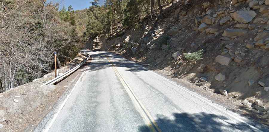
This picturesque route is entirely paved. The drive encompasses portions of California Highway 138 (Cajon Pass to Crestline), California Highway 18 (from Crestline to Big Bear Dam), and California Highway 38 (from Big Bear Dam to Mill Creek Canyon).
How long does it take to drive the Rim of the World Highway?
Plan up to two hours of drive time one-way without any stops. Try to get out early on a weekday to avoid having to pass a lot of people. Also, watch for police on touristy days; they will be around every bend.
Is the Rim of the World Highway worth it?
The road will take you along the most fascinating scenery in the state and offers stunning views along the cliffs of the San Bernardino. It travels through desert and coastal valley to high elevation forests and several lakes, some of the most naturally beautiful areas left in Southern California. Spectacular vistas and panoramas exist everywhere along the route. Distant views are affected by summer smog.
Is the Rim of the World Highway challenging?
It’s suitable for all types of vehicles. It’s winding and steep in parts. Use pullouts and watch for other traffic.
Is the Rim of the World Highway open?
Tucked away in the San Bernardino National Forest, the road is typically open all year round, with the occasional closure in winters due to dangerous weather conditions. You may need chains in the winter as this area does receive snow. When snowing, roads are closed or chains are required.