The Wild Road to Ptarmigan Pass in the Sawatch Range of Colorado
Ptarmigan Pass is a high mountain pass at an elevation of 3.352m (11,777ft) above sea level, located on the boundary between Summit and Eagle counties in the US state of Colorado.
Where is Ptarmigan Pass?
The pass is located in the central part of Colorado, within the White River National Forest.
Is the road to Ptarmigan Pass unpaved?
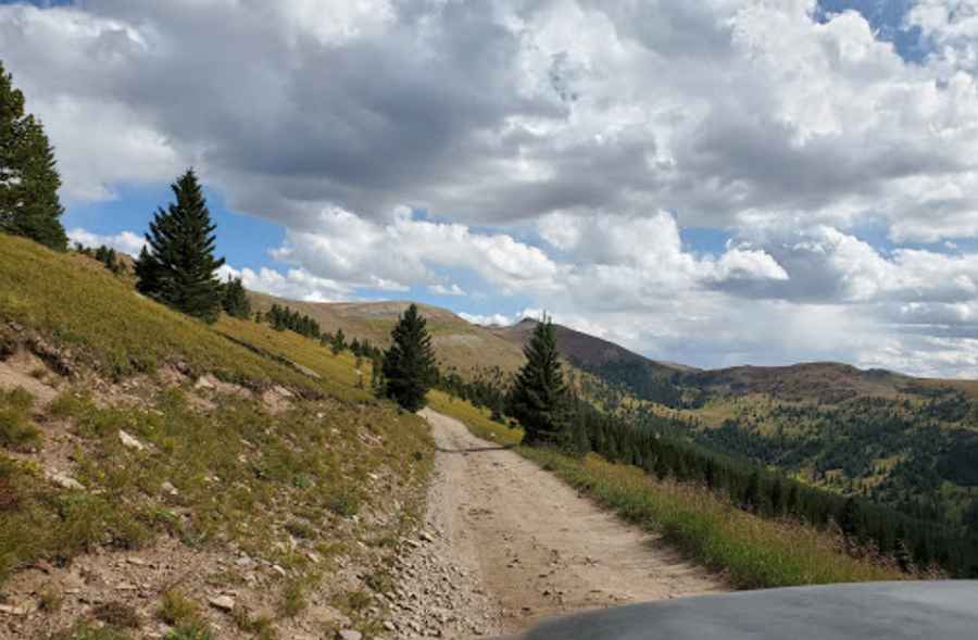
The road to the summit is totally unpaved. It’s called Forest Road 747. It’s passable by 4wd vehicles. 2WD vehicles will only be able to reach the summit from the west. The road itself curves sharply in several places. The trail is usually rocky as it follows the creek, and some sections can be difficult. When the rocks are wet, it can be even more difficult.
How long is the road to Ptarmigan Pass?
The road to the summit is 9.65km (6.0 miles) long, running from Resolution Creek Road to Forest Road 709 (Turkey Creek Road). West of the pass, a 4x4 gravel road climbs up to Ptarmigan Hill, a high mountain peak at an elevation of 3.681m (12,076ft) above sea level.
Is the road to Ptarmigan Pass open in winter?
Set high in the Rocky Mountains, on the northern end of the Sawatch Range, the road is impassable in winter.
Pic: David Salter