Ebbetts Pass is a very steep narrow road in Sierra Nevada
Ebbetts Pass is a high mountain pass at an elevation of 2.666m (8,746ft) above sea level, located in Alpine County, in the US state of California. The pass is not plowed for snow. It is an idyllic drive for those who crave tight switchbacks, tiny hamlets, and multiple alpine vistas.
Where is Ebbetts Pass?
The pass is located in the eastern part of California, to the east of Pacific Grade Summit.
Why is it called Ebbetts Pass?
John Ebbetts, a former fur trader turned guide for California Gold Rush prospectors, led a group of pack mules over the Sierras near what is now known as Ebbetts Pass in April 1851. He believed this route could be suitable for the proposed transcontinental railroad, as he encountered little snow during his journey. Later, he surveyed the area for a potential railroad route but deemed it unsuitable. Although he planned to return to survey the pass itself for a road, he tragically died in an explosion on the steamboat Secretary in 1854. Despite earlier references to the pass by his name, it was officially named after him in 1893 by the U.S. Geological Survey during their survey of the Markleeville quadrangle.
Is the road to Ebbetts Pass in California paved?
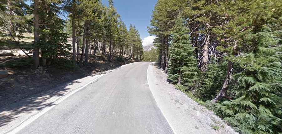
Set high in the Sierra Nevada range, the road to the summit is totally paved. It’s called California State Route 4, also known as Alpine State Highway, part of the Ebbetts Pass National Scenic Byway. It’s one of the least traveled passes in the Sierra Nevada.
How long is Ebbetts Pass?
The pass is 98km (61-mile) long, running from Arnold (in Calaveras County) to Markleeville (in Alpine County).
Is Ebbetts Pass open?
The pass marks the highest point of the road. The pass usually remains open until the first heavy snowfall of the winter arrives. Often that occurs sometime in early November. The highway reopens in the spring after snowmelt, normally by Memorial Day, but sometimes as early as April or as late as July depending on snow conditions.
How steep is Ebbetts Pass?
The road is very steep and features countless blind hairpin corners, hitting a 24% of maximum gradient through some of the ramps. It is rarely used by commercial traffic and is not recommended for vehicles towing long trailers. It is not suitable for large trucks, buses, or RVs, as it becomes very steep and narrow, with no center dividing line shortly after the Mount Reba Turnoff to Bear Valley Ski area, with tight switchbacks. It winds in improbably steep switchbacks around large tree trunks and truck-sized boulders, climbing the next ridge. The eastern slope is particularly difficult, as many of the hairpin corners are blind, and steepen suddenly at the apex, making it necessary to shift to first gear in most vehicles. The road, past Bear Valley, gets very narrow.