Ultimate 4WD Destination: Leviathan Peak in California
Leviathan Peak is a high mountain peak with an elevation of 2,732m (8,963ft) above sea level, located in Alpine County, in the U.S. state of California. The views from the summit are impressively remote.
Where is Leviathan Peak?
The peak is located southeast of Lake Tahoe, in the eastern part of California, near the Nevada border, within the Humboldt-Toiyabe National Forest.
What’s at the summit of Leviathan Peak?
The summit features transmission facilities (Leviathan Peak Communication Site, established in the 1960s) and an old abandoned fire lookout known as the Forest Service Leviathan Fire Lookout. The peak offers stunning 360-degree views of the surrounding landscape, and on a clear day, you can see the Sierra Mountain range, nearby peaks, and the lower Nevada desert.
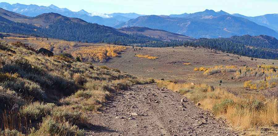
Is the road to Leviathan Peak unpaved?
Yes, the road to the summit is completely unpaved. It’s known as Leviathan Peak Road (Forest Road 31057), and only 4WD vehicles are recommended. You can drive up to a locked gate, leaving just a short 1/4-mile hike to the fire tower. The final section is accessible only to service vehicles.
How long is the road to Leviathan Peak?
The road to the summit is 2.25 km (1.4 miles) long, starting from California State Route 89 (Robert M. Jackson Memorial Highway), south of Monitor Pass. The elevation gain over this distance is 216 meters, with an average gradient of 9.6%.
Is the road to Leviathan Peak open in winter?
Located high in the northern Sierra Nevada mountain range, the road is closed in winter and typically opens from early April to late November. It can be very windy at the summit.
Pic: David Goulart