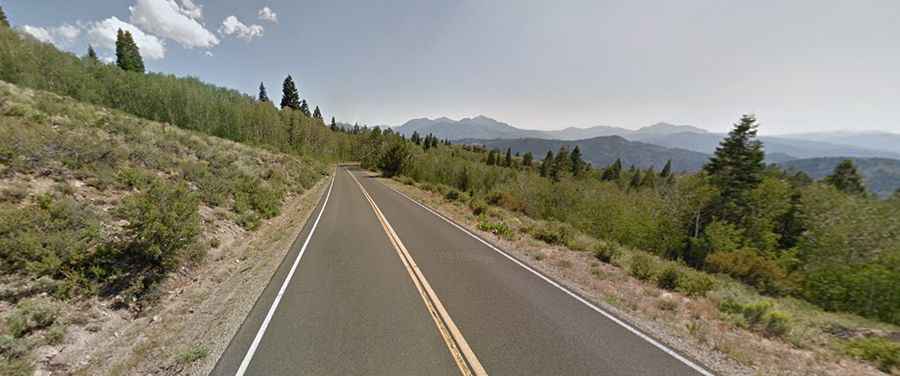
The iconic road to Monitor Pass in California
Monitor Pass is a high mountain pass at an elevation of 2.543m (8,343ft) above sea level, located in the U.S. state of California. The road is closed in winter.
Where is Monitor Pass in California?
Tucked away in the east-central portion of California, near the Nevada border, the pass is located on the boundary between Alpine and Mono counties. The traffic is light, and the road feels remote.
When was Monitor Pass in California built?
The road through the pass was completed in the early 1950s. It’s named after the silver mining town of Monitor.
How long is Monitor Pass in California?
Located southeast of Lake Tahoe, the road to the summit is totally paved. It’s called California State Route 89 (Robert M. Jackson Memorial Highway). The pass is 28.32km (17.6 miles) long, running west-east from Alpine State Highway, south of Markleeville, to US-395, north of Coleville.
Is Monitor Pass open in California?
Set high in the Sierra Nevada range, this road is usually closed from late November through early April (depending on snow). Dates of closure vary depending on the weather. Near the summit, a minor gravel road climbs up to Leviathan Peak, at an elevation of 2.438m (8,942ft) above sea level.
What is the grade of Monitor Pass?
The road is steep, hitting a 13% maximum gradient through some of the ramps. The grade is steeper on the side going toward US 395, so take it easy going down and be prepared for the tough part of the return climb back to the summit. Plan 30 minutes to complete the drive without any stops.