Driving the rough 4×4 road to Argentine Pass in Colorado
Argentine Pass is a high mountain pass at an elevation of 4,034m (13,234ft) above sea level, located in the U.S. state of Colorado. It's one of the highest roads in Colorado.
Where is Argentine Pass?
The pass is located on the boundary between Clear Creek and Summit counties, in the northern part of Colorado, within the White River National Forest.
When was the road through Argentine Pass built?
The first road through the pass was a wagon road built in 1867. It was constructed to connect the towns located on the western slope of the Continental Divide with the eastern slope towns.
How long is the road to Argentine Pass?
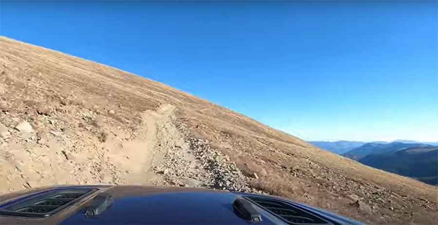
The road to the summit, formerly known as Sanderson Pass and Snake River Pass, is totally unpaved. It’s called County Road 352. The pass road is 12.71km (7.9 miles) long, starting at Guanella Pass Road (County Road 381).
Is the road to Argentine Pass in Colorado dangerous?
It’s a narrow, very steep, and loaded with hairpin turns rough 4×4 road. High clearance 4×4 vehicles only. Over-sized vehicles are not advised. The route is extremely rocky and gets very narrow at the top. This is a moderate trail with some very rocky sections and a couple of deep stream crossings.
Is the road to Argentine Pass open?
Set high in the Front Range of the Rocky Mountains of Colorado, the road is subject to seasonal closure. Snow can block the trail well into summer. It’s only passable in good weather during the summer. Vehicle travel is only possible on the Georgetown side of the pass. On the Horseshoe Basin side is only accessible by foot or by mountain bike.
Is the road to Argentine Pass scenic?
The drive offers stunning views, and there’s plenty of parking at the top. Don’t miss Santiago Mine and Ghost Town. (Caution: Mine is on private property. Stay on the road and well away from buildings). Spectacular views are enjoyed from both sides of the Continental Divide upon reaching the summit. Grays & Torreys Peaks are visible to the north. After enjoying the view, return the way you came, and enjoy the fun and fast ride back. Great views of Peru Creek looking down from the top.
Is the road to Argentine Pass steep?
The road to the summit is very steep. Starting at Guanella Pass Road (County Road 381), the elevation gain is 1,126 meters. The average gradient is 8.85%.
Pic&Video: Trail Traveler