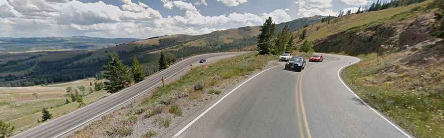
A curvy paved road to Craig Pass in the heart of Yellowstone
Craig Pass is a high mountain pass at an elevation of 2,525m (8,284ft) above sea level, located in Teton County, in the U.S. state of Wyoming.
Why is it called Craig Pass?
The pass was named after Ida Craig, believed to be the first tourist to cross it after its completion in September 1891.
Is the road to Craig Pass in Wyoming paved?
Tucked away in Yellowstone National Park, the road to the summit is fully paved. It’s called Grand Loop Road (U.S. Route 191). The drive is scenic but expect countless turns and twists. At the summit, there's a small parking area and a little lake known as Isa Lake, though it more resembles a pond than a lake.
How long is Craig Pass in Wyoming?
The pass is 27.19km (16.9 miles) long, running from West Thumb Junction to Old Faithful. Some sections of the road are quite steep, with gradients reaching up to 7.9%.
Is Craig Pass in Yellowstone National Park open in winters?
Set high in the Continental Divide, the road is closed to regular vehicles from early November to late-April, and is open to limited oversnow travel (commercially-guided snowmobiles and snowcoaches) from mid-December to mid-March. When open, roads are not gated at night and people may enter/exit the park 24 hours a day, seven days a week. Yellowstone has five entrance stations, and it takes several hours to drive between them. Anticipate possible road closures, and check the road status of the entrance you intend to use before traveling.