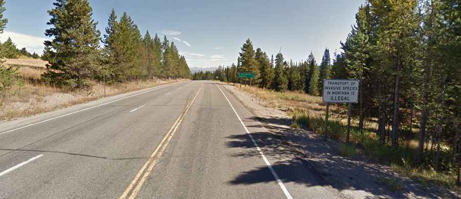
A paved road to Targhee Pass in the Henrys Lake Mountains
Targhee Pass is a high mountain pass at an elevation of 2.161m (7,089ft) above sea level, located on the border between Idaho and Montana, in the USA.
Where is Targhee Pass?
The pass is located on the Continental Divide, along the border between southeastern Idaho and southwestern Montana.
Why is it called Targhee Pass?
The pass was named for a Bannack Indian chief.
Is Targhee Pass paved?
The road to the summit is totally paved. It’s called U.S. Highway 20 (Targhee Pass Highway). Along the route are a few white markers representing highway fatalities.
How long is Targhee Pass?
The pass is 45km (28 miles) long, running from West Yellowstone (a town in southern Montana) to Island Park (a city in Fremont County, Idaho). The road is mostly flat but hits an 8% maximum gradient through some of the ramps.
Is Targhee Pass open?
Set high in the Henrys Lake Mountains, within the Caribou–Targhee National Forest, the road is open in the winter and plowed on a regular basis and sanded. The only time it would be closed is if there is a blizzard.
How long does it take to drive Targhee Pass?
Tucked away in the Caribou–Targhee National Forest, on the border of Fremont County (in the U.S. state of Idaho) and Gallatin County (in the U.S. state of Montana), plan about 30 minutes to complete the drive without any stops. However, due to its beauty, the drive will take longer. The pass is a high-volume area for migrating elk, deer, moose, and bears. The pass provides the most direct access to Yellowstone Park from southern Idaho.