A road with sweeping views to Nez Perce Pass between Idaho and Montana
Nez Perce Pass is a high mountain pass at an elevation of 2.012m (6,601ft) above sea level, located on the border of Idaho and Montana, in the USA. Travel at your own risk.
When Was the Road to Nez Perce Pass Built?
The road was built by the Civilian Conservation Corps (CCC) in the 1930s.
Is the Road to Nez Perce Pass Paved?
Located in the Bitterroot Mountains, the road to the summit is mostly paved, with some sections on either side unpaved. The road is known by several names, including Forest Road 468, Nez Perce Pass Road, Magruder Corridor Road, Southern Nez Perce Trail, Elk City to Darby Road, Montana Road, and Parker Trail.
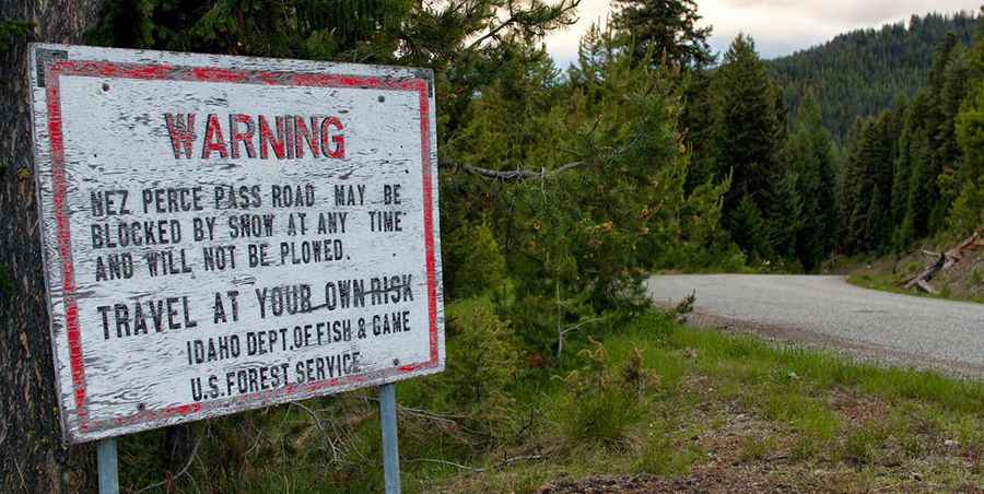
Is the Road to Nez Perce Pass Open?
The road may be blocked by snow at any time and is not plowed.
How Long Is Nez Perce Pass on the Boundary of Idaho and Montana?
The pass is 150 km (93.6 miles) long, running east to west, from W Fork Road (in Idaho) to Dixie Road (in Montana). Due to the rugged conditions, travelers should expect to drive at an average speed of 12-15 miles per hour. This route offers a remote corridor between two of Idaho’s largest wilderness areas: the Frank Church River of No Return Wilderness and the Selway Bitterroot Wilderness.
Is Nez Perce Pass Worth It?
The drive provides stunning mountain views. At the summit, there is a paved parking area with a helicopter pad for emergencies. An interesting feature of the pass is the change in time zones, from the Pacific Time of northern Idaho to the Mountain Time observed in Montana.
Pic&more info:http://fluidasalifestyle.blogspot.com/2014/04/the-selway-river-2013.html