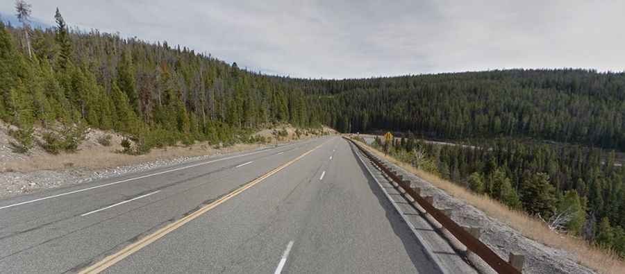
The paved road to Lost Trail Pass on the Montana-Idaho border
Lost Trail Pass is a high mountain pass at an elevation of 2.143m (7,030ft) above sea level, located on the border between Idaho and Montana, in the northwestern United States.
Where is Lost Trail Pass?
The pass is located on the border of the states of Montana and Idaho, specifically between Ravalli County in Montana and Lemhi County in Idaho.
Why is it called Lost Trail Pass?
The area around Lost Trail Pass is historically significant due to its connection to the Lewis and Clark Expedition. The expedition crossed the Bitterroot Mountains near this region in 1805. The name 'Lost Trail Pass' is derived from an incident during the expedition when the explorers temporarily lost their trail in the rugged terrain.
How long is the road to Lost Trail Pass?
The road to the summit is totally paved. It’s called U.S. Highway 93. The pass is 42.16km (26.2 miles) long, running north-south from Sula (in Ravalli County, Montana) to Gibbonsville (in Lemhi County, Idaho).
Is Lost Trail Pass open in winter?
Set high in the Bitterroot Mountain Range of the Rocky Mountains, the road is usually open to traffic throughout the year. It can be challenging during the winter months due to heavy snowfall and icy conditions. It is advisable to check weather and road conditions before traveling.