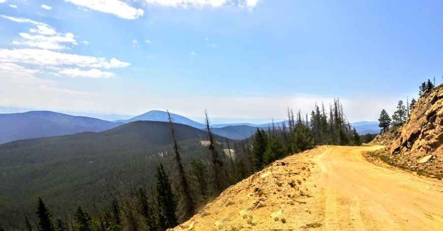
A pleasant gravel road in summers to Old Monarch Pass in Colorado
Old Monarch Pass is a high mountain pass at an elevation of 3.473m (11,394ft) above sea level, located in the U.S. state of Colorado.
Where is Old Monarch Pass?
The pass is located on the boundary between Gunnison and Chaffee counties, in the west-central part of Colorado. The pass is located just west of the present-day Monarch Pass.
When was the road to Old Monarch Pass built?
The first road crossing the Original Monarch Pass was a toll-road constructed 1880 and in 1921 opened to vehicles.
Can you drive through Old Monarch Pass in CO?
The road to the summit is totally unpaved. It’s called County Road 237. The road is well graded and the scenery is quite nice at the pass. This road can be traversed by passenger vehicles at most times during the summer and early fall months. It is pretty steep, hitting an 8% of maximum gradient through some of the ramps. The pass is filled with switchbacks, hairpin turns, steep cliffs, and there are no guardrails whatsoever.
How long is the road to Old Monarch Pass in CO?
The pass is 17.05km (10.6 miles) long, running west-east from County Road 888 to US-50.
Is the road to Old Monarch Pass in CO worth it?
Running through scenic surroundings, at the summit on a clear day, you can see the entire breadth of the Rockies, from Pikes Peak to the San Juans.
Is Old Monarch Pass in Colorado open?
Set high at the southern end of the Sawatch Range, in San Isabel National Forest, the road is usually impassable from late October through late June or early July (depending on snow). Heavy rainfalls occasionally wash out the east entrance to the pass. The area is prone to severe storms and heavy gusts of wind.
Pic: zed Timmy