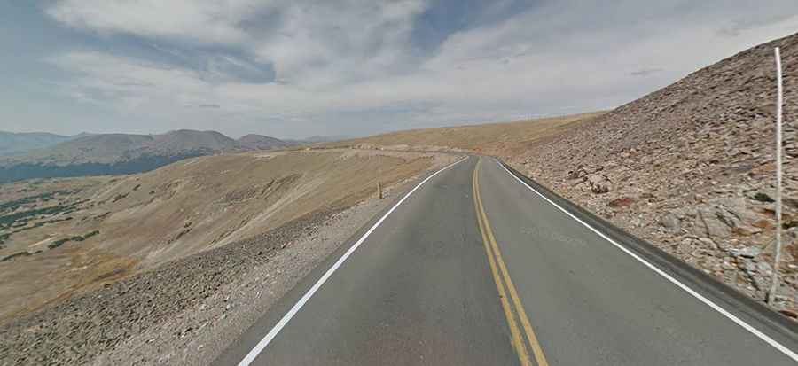
Trail Ridge Road is the highest continuous paved road in the USA
Trail Ridge Road is the name for a stretch of U.S. Highway 34 with a length of 48 miles (77 km) straddling Larimer and Grand counties, in the U.S. state of Colorado. It is said to be the highest continuous paved road in the country.
Where is Trail Ridge Road?
Tucked away in Rocky Mountain National Park, the road, also known as Trail Ridge Road/Beaver Meadow National Scenic Byway, cuts through Rocky Mountain National Park between the towns of Estes Park and Grand Lake, and is one of the best ways to see the Continental Divide as it cuts through Colorado.
Why is it called Trail Ridge Road?
The name "Trail Ridge Road" derives from its proximity to historic pathways used by native peoples to cross the Rocky Mountains. It traverses Rocky Mountain National Park from Estes Park, Colorado, in the east to Grand Lake, Colorado, in the west.
When was Trail Ridge Road built?
Construction of the road began in 1929 by the Civilian Conservation Corps and was completed to Fall River Pass by July 1932 with a maximum gradient of 7% through some of the ramps.
Is Trail Ridge Road scary?
The road is totally paved in good condition. However, if you don’t like heights, be warned: there are switchbacks and steep sides with very few barriers on this route through the mountains. The road is actually far less scary than many of Colorado's famous mountain roads. The speed limit is low.
Is Trail Ridge Road the highest paved road?
Rocky Mountain National Park features the highest paved roads in any National Park in the United States. The Trail Ridge Road is said to be the highest continuous paved road in the country, topping out at 3,721 m (12,209 ft) above sea level. Along its route, it climbs over three historically and geographically significant high mountain passes:
- Milner Pass (3,279 m / 10,758 ft): This pass is located on the Continental Divide boundary between Larimer and Grand counties. It was named after T.J. Milner, a railroad promoter whose surveyed route for a potential railroad was never completed.
- Fall River Pass (3,595 m / 11,796 ft): Located on the boundary between Grand and Larimer counties, this pass allows access to the scenic Old Fall River Road to the east.
- Iceberg Pass (3,605 m / 11,827 ft): Situated in Larimer County, this pass marks one of the highest points achieved along the drive.
Is Trail Ridge Road closed?
The road is closed during the winter, and often remains closed until late spring or early summer depending on the snowpack. It requires access to Rocky Mountain National Park even for local residents. Road conditions in and around the park can change quickly, particularly in the spring and fall.
How many miles is Trail Ridge Road?
The road is 48 miles (77 km) long running from Estes Park on the park's east side to Grand Lake on the west.
Is Trail Ridge Road worth it?
This road will provide you with some unique and exciting driving experience. The drive itself is picturesque and not particularly challenging.
How long does it take to drive Trail Ridge Road in Rocky Mountain National Park?
This is a remarkable road trip. Make sure you leave enough time to make plenty of stops along the way. Put aside at least a half day for the trip. Longer, if possible. It can be very crowded during holidays. Definitely take your time and stop at as many viewpoints as you can. It’s heavily traveled by inexperienced tourists, who end up driving in the middle of the road. Summer days and weekends are very busy, especially between 9 am and 3 pm, so plan accordingly.