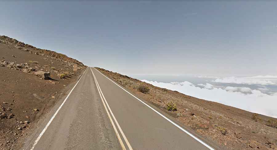
Haleakala Highway in Hawaii: blind turns and very steep drop offs
Haleakala Highway is a challenging road located on the Hawaiian Island of Maui, in the USA. It holds the world record for climbing to the highest elevation in the shortest distance of 35 miles.
How long is the road to Haleakala?
Set high within Haleakalā National Park, the road (also known as Crater Road and Route 378) is totally paved. It’s 56km (34.9 miles) long, running east-west from Kahului to Pu'u'ula'ula (Red Hill), the tallest peak of Haleakalā mountains, at an elevation of 3,055m (10,023ft) above sea level.
When was the road to Haleakalā built?
Construction of the road started in 1933 and took two years to complete, opening to the public in 1935.
Is it difficult to drive to Haleakalā?
The two-lane road is very challenging, featuring a 15% maximum gradient through some of the ramps. The elevation gain is 3021m, and the average gradient is 5.39%. It is a well-maintained two-lane highway containing many blind turns and very steep drop-offs without guardrails, mainly composed of 32 switchbacks. Sometimes animals, including cows and nene geese, cross the highway. Watch out for poor visibility due to fog. Note the last chance to buy food and gas is at Pukalani or Makawao. The National Park Service has suspended commercial bicycle tours within the park after some fatal bike accidents there in a year.
How long does it take to drive to the top of Haleakalā?
To drive the road without stopping will take most people between 1 and 1.5 hours. The road features scenic views of Haleakala's "moonlike" scenery. As you climb, notice that the temperature is dropping -- about 3 degrees F for each 1,000 feet in altitude. If it is 75 degrees near sea level, plan on about 45 degrees at the summit of Haleakala. Driving through the road, you pass through as many ecological zones as you would on a journey from Mexico to Canada.