Driving the enthralling Notom-Bullfrog Road in Capitol Reef NP
Notom-Bullfrog Road is a very scenic drive running across Capitol Reef National Park, in the US state of Utah. It runs along the eastern side of the Waterpocket Fold and is considered one of the best drives in Capitol Reef National Park.
Where is the Notom-Bullfrog Road?
The road straddles Wayne and Garfield counties in the south-central part of Utah.
How long is the Notom-Bullfrog Road?
The road is 52.30 km (32.5 miles) long, leading from Highway 24 along the east side of Capitol Reef National Park to the junction of Burr Trail Road in the southern section of the Park.
Is the Notom-Bullfrog Road paved?
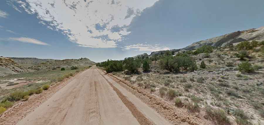
The road is paved for the first 15 miles (24.1 km) and then becomes a maintained dirt road, sandy and gravel.
Is the Notom-Bullfrog Road dangerous?
The road is suitable for passenger cars in good weather conditions. It reaches an elevation of 1,745m (5,725ft) above sea level. Visitors are advised to check with the visitor center before driving on the road. Sometimes, it is impossible even for 4WD vehicles, especially in wet weather or after recent storms or floods.
How long does it take to drive the Notom-Bullfrog Road?
Located high in Capitol Reef National Park, plan up to two hours of one-way drive time without any stops. The road will take you along some of the most fascinating scenery in the state. Enjoy the views along this backway as it skirts the eastern edge of the Waterpocket Fold, a geological wonder that extends along the length of the road. Several narrow canyons intersect the road, and exploring them is rewarded with spectacular geological formations. The road offers excellent scenery and hiking opportunities, running along the eastern side of the Waterpocket Fold. Access to many of the park's backcountry trails, such as Lower Muley Twist and Halls Creek Narrows, can be found off this road.