A Once in a Lifetime Drive through Hell's Backbone Road in Utah
Hell's Backbone Road is a very scenic unpaved road located in Garfield County, in the US state of Utah. This one-way road is closed in winters. The drive offers heavenly day tripping.
Where is Hell's Backbone Road?
The road is located within the Dixie National Forest, in Garfield County, in the southern part of Utah, through the Escalante Ranger District.
When was Hell's Backbone Road built?
The road was constructed by the CCC (Civilian Conservation Corps) during the Great Depression era in 1933 as the first-ever automobile route between the towns of Escalante and Boulder. Given the sheer drop along some stretches, it was the CCC crews who dubbed it the Poison Road – one false step, and down you go. The road is named after a very narrow ridge traversed by the road.
How long is Hells Backbone Road Utah?
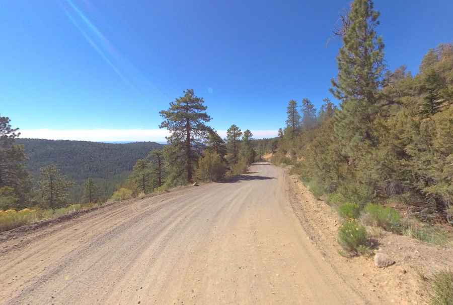
The road, part of Forest Road 153, is 61 km (38 miles) long, running from Boulder to Escalante. The road is totally unpaved, graded occasionally, and suitable for family cars during dry weather. It is a high-country alternative to the paved Utah Scenic Byway 12, which also connects Boulder and Escalante. It’s a slow drive but well worth taking if you have the time.
Is Hell's Backbone Road challenging?
The drive is pretty challenging. It’s easily passable by ordinary passenger vehicles, but it is very narrow and winding, and not for the faint of heart. It follows a narrow hogsback with sheer drops to both the right and the left. It is steep in spots and can be treacherous during stormy weather. The ride is rather remote, so you need to be prepared. This is not a road you should take alone if you are not in good health as it is remote. It can be treacherous to travel in the wrong weather or under the wrong road conditions. There is no cell phone coverage.
Is Hell's Backbone Road open?
This is a high mountain road, topping out at 2,814m (9,232ft) above sea level. It’s closed in winters and becomes impassable after the first major snowfall.
Is Hell's Backbone Road worth it?
The drive offers sweeping views and provides access to spectacular country. The journey is famous for its scenery and history. It offers unforgettable views into canyons far below. Halfway along the road is Hell's Backbone Bridge, which is 109 feet (33 m) long and 14 feet (4.3 m) wide. A 1,500-foot (460 m) drop is on either side. Hell’s Backbone Bridge, a must-stop for taking photographs, allows travelers to pass above Sand Creek with views of the spectacular Box-Death Hollow Wilderness Area. Summer is when Hell's Backbone gets the most traffic.
How long does it take to drive Hell's Backbone Road?
Plan 2-3 hours to complete the remarkable drive without stops, although you may want to block out extra time to stop, take photos, and explore the region it passes through.
Pic: Shannon Bushman