Carr Canyon Road in Arizona: narrow and steep with no guard rails
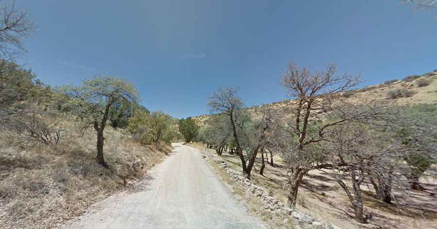
Carr Canyon Road #368 is a winding, steep, gravel switchback road located in Cochise County, in the U.S. state of Arizona.
When was Carr Canyon Road built?
It was built at the turn of the century for mining purposes and reconstructed in the late 1930s by the CCC.
Where is Carr Canyon Road?
The road is located in the southeastern corner of Arizona, within the Coronado National Forest.
How long is Carr Canyon Road?
The road is 12.55km (7.8 miles) long, running from the paved AZ-92 to Ramsey Vista Campground, on the Huachuca Mountains, at 2,256m (7,401ft) above sea level.
Is Carr Canyon Road unpaved?
The road is mostly unpaved and rough in spots: the first mile or so is paved; the rest is dirt and suitable for two-wheel-drive vehicles.
Is Carr Canyon Road #368 challenging?
The road features narrow, winding, and steep parts. One-lane switchbacks and hairpin curves add a little excitement to this scenic route. The road slashes up the slopes of the mountain at a dizzying tilt. Without guardrails or retaining walls, travelers might experience a whiff of anxiety as they navigate one-lane switchbacks and hairpin curves. Vehicles longer than 20 feet and trailers longer than 12 feet are prohibited beyond Carr Canyon Picnic Area.
How long does it take to drive Carr Canyon Road #368?
Plan about 40 minutes to complete the drive, without any stop. It’s the only road into the upper reaches of the Huachuca Range. Since the road is so narrow, it’s recommended that you use one of the pullouts along the road if you want to stop and enjoy the view. The road provides the reward of extraordinary views of Sierra Vista, the San Pedro Valley, and a number of surrounding mountain ranges as it winds its way up the mountain. At the top is a Coronado National Forest campground with restrooms only. This area is full of hiking trails.
Is Carr Canyon Road #368 open?
Set high in Sierra Vista, the road is seasonally closed (usually from December 15 to March 15).
Is Carr Canyon Road #368 steep?
The road to the summit is very steep, hitting a 12% maximum gradient through some of the ramps. Starting at AZ-92, the elevation gain is 775 meters. The average gradient is 6.17%.