An awe-inspiring drive to Paulina Peak in Oregon
Paulina Peak is a high mountain peak at an elevation of 2.434m (7,984ft) above sea level, located in Deschutes County, in the U.S. state of Oregon. It’s one of the highest roads in Oregon.
Where is Paulina Peak?
The peak is located in the central part of Oregon, within the Newberry National Volcanic Monument.
Can I drive to the top of Paulina Peak?
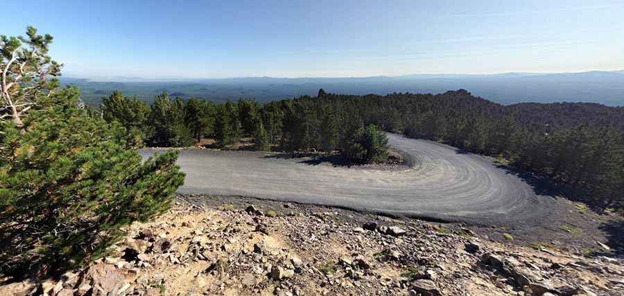
The road to the summit is called NF-500 (Paulina Peak Road). Starting at Forest Service Road 21, the road is 6.27km (3.9 miles) long.
Is the road to Paulina Peak paved?
The road to the summit is totally unpaved but navigable by most passenger vehicles. Vehicles less than 23' in length (passenger cars, pick-ups, and vans) can be driven on this steep and dusty road; however, it is quite rough and narrow in some places. Parking at this site requires a recreation pass.
Is the road to Paulina Peak steep?
The climb to the summit is pretty steep. The elevation gain is 481 meters. The average gradient is 7.67%. It hits a maximum gradient of 9%.
Is Paulina Peak Road open?
Set high in the Deschutes National Forest, the road is usually closed due to snow in winters, until early July, and will close in late October/early November.
Is Paulina Peak worth it?
This is one of those "must-see" things in Oregon. Plan about 25 minutes to complete the remarkable drive without stops, although you may want to block out extra time to stop, take photos, and explore the region it passes through. It was once the home of a Forest Service lookout tower, hence the gravel road, but the tower was ultimately removed in 1968. This site offers a grand overview of the Newberry Caldera, the south and west flanks of the Newberry Volcano, the Cascades, the Fort Rock Basin, and much of central Oregon. On a clear day, the Cascade Range is visible extending into California (Mt. Shasta) and Washington (Mt. Adams). Bears are common at all of the campsites within the crater.
Pic: Chad Stingle