Kaiser Pass is a classic road trip in Sierra National Forest
Kaiser Pass is a high mountain pass at an elevation of 2,803m (9,196ft) above sea level, located in Fresno County, in the U.S. state of California. It’s one of the highest roads in California.
How long is the road to Kaiser Pass?
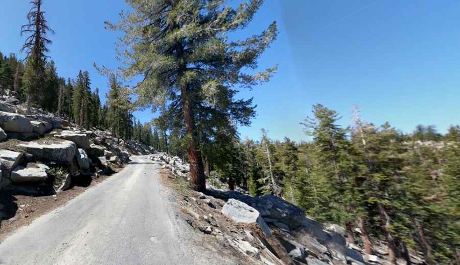
The narrow, bumpy road to the summit is totally paved. It’s called Kaiser Pass Road. It’s 36.04km (22.4 miles) long, running from CA-168 (near Huntington Lake) to Florence Lake.
Is the road to Kaiser Pass dangerous?
If you’re scared of driving on narrow mountain roads, where you’ll have to reverse if you meet another vehicle, this road is not for you; better avoid it. It’s a narrow one-lane winding mountain road, so proceed cautiously. In parts, it’s just wide enough to pull over to let others pass. Large vehicles and trailers are not recommended. The road is steep, hitting a 12% maximum gradient through some of the ramps. For most of its length, it feels more like a goat path: 1 1/2 lanes wide, steep, winding, exposed, and full of potholes. There are numerous turnouts along the road, but sometimes when vehicles meet, one vehicle has to back up a little for a turnout; it is usually best to back up past the turnout using only your side mirrors and then drive forward into the turnout. The first 5 miles of the Kaiser Pass road are a nice smooth two-lane highway; then the last 12 miles turn into a rather narrow and curvy more or less one-lane road but paved. You can only drive about 20 MPH. There are only 3 areas that are cliffy.
Is Kaiser Pass open?
Set high in the central portion of California, the road is closed to vehicular traffic in the winter. It is typically open from late May through mid-November. Winter driving in the Sierra National Forest may require tire chains & cables. Be prepared for rapidly changing conditions.
How long does it take to drive the Kaiser Pass Road?
Located within the Sierra National Forest, it’s a scenic drive through the mountains. Plan 1.5 hours to complete the drive without any stops. This is bear country. Please store food properly and do not feed the bears. Remember to bring mosquito repellent.
Pic: Corey Hass