Driving Mount Evans Scenic Byway, the highest paved road of North America
Mount Evans is a high mountain peak at an elevation of 4,310m (14,130ft) above sea level, located in Clear Creek County, in the U.S. state of Colorado. The road to the summit, the iconic Mount Evans Scenic Byway, is said to be the highest paved road in North America.
How long is the road to Mount Evans?
Starting at the paved Mestaa’Ėhehe Road (formerly Squaw Pass Road), also known as Colorado State Highway 103, the Mount Evans Scenic Byway is 23.17km (14.4 miles) long. It’s a toll road, totally paved. There is a park fee charged if using parking lots and facilities along the upper portion of the byway.
How long does it take to drive the Mount Evans Scenic Byway?
Located just 60 miles west of Denver, plan 45 minutes without any stops to complete the drive. The best time to travel to the summit is in the summer. It is best to try to time your trip up the mountain for a day when thunderstorms are expected in the “low country” around Denver. There are few quicker boosts better than watching a thunderstorm unfold below as you sit under a sun-kissed blue sky at 14,000 feet. The road ends at a parking lot with the remains of the Crest House. It was a gift shop and restaurant until it burned in 1979, but the ruins are left today as a windbreak. In 1895, the mountain was officially named “Mount Evans,” after John Evans, the second territorial governor of Colorado.
Is the Mount Evans Scenic Byway worth it?
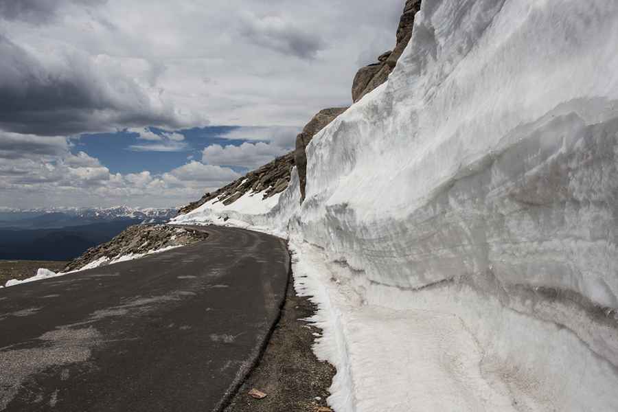
The road is very scenic. You will pass through five life zones, passing ancient trees, lakes, and forest to the land above timberline. In addition to being such a high elevation road, the drive has one other thing in its favor: it is so close to Denver, the largest city in the U.S. state of Colorado, that it gives a fantastic aerial view of a large North American metropolitan area. The route takes the visitor from open ponderosa and juniper hills and open meadows, up through deep spruce forests and into the magnificent splendor of the alpine environment. Those who have driven to Mount Evans recommend taking it slow and admiring the scenery. This drive offers visitors scenic views of the Continental Divide, mountain goat and bighorn sheep herds, marmots, birds and alpine wildflowers, and the Rocky Mountain Bristlecone Pine trees. Gems along the byway include the Mount Goliath Nature Area, Summit Lake Park, and the Crest House at the summit. The views up to Mount Evans are breathtaking, with alpine lakes, massive granite walls, and strands of twisted, ancient bristlecone pine. Clouds may obscure visibility and snow can occur at any time, but there are many pull-offs for foolhardy travelers to stop and take pictures along the way.
When was the Mount Evans Scenic Byway built?
Part of the Front Range along the eastern edge of the Rockies, construction of the road began on July 22, 1923, and by 1930 it was completed. In June of 1931, the road opened to the public. This route was designated a Forest Service Byway on July 1, 1993, by the US Forest Service and has also been designated a Colorado Scenic Byway by the Colorado Department of Transportation. The road is a beautiful work of civil engineering with perfect curves and wide lanes. A new extension was added to the byway from Echo Lake to Bergen Park via Clear Creek County Road 103 and Jefferson County Road 66. At the time of its construction, the Mount Evans Road was the highest in the world.
Is the Mount Evans Scenic Byway scary?
If you're afraid of heights, it's probably best to keep your eyes forward. The road has many switchbacks on the mountain and terrifying drop-offs without guardrails. Vehicles over 30' long are not recommended due to the steep, narrow, and winding road. It's one of the highest roads of Colorado. On the descent, travelers should heed the warning and descend on the road in a lower gear so that their brakes do not overheat and lose their effectiveness. Along the way, there are many pull-offs to rest the brakes. Note that the higher the elevation, the more important it is to stay hydrated - and be aware that the significant drop in air pressure makes exercise more difficult; some may not want to climb that last bit to the top.
Is the Mount Evans Scenic Byway open?
The byway only requires 2WD vehicles. The road to the top is typically opened in May (Memorial Day) when the Colorado Department of Transportation (CDOT) has completely plowed the road, but it can be closed anytime when the access is not cleared of snow. Usually, the road to Summit Lake is opened before the last 5 miles to the summit is opened. Once opened, the road is open 24 hours a day, 7 days a week. Unlike Pikes Peak that is only open from 7:00 am to 7:00 pm. CDOT has returned to closing the top five miles the day after Labor Day. CDOT says that the first 10 miles (of 15 to the summit) will be open until the "first significant snowfall" or the first weekend in October, whichever is first. Exactly what is a "significant snowfall" is not defined.
Is the Mount Evans Scenic Byway steep?
The road to the summit is very steep. Starting at Squaw Pass Road (State Highway 103), the elevation gain is 1,053 meters. The average gradient is 4.54%.
Image credit: Depositphotos