How to drive the scenic U.S. Route 101 along the Oregon Coast?
U.S. Route 101 in Oregon (officially Oregon Coast Highway No. 9) is a fully paved two-lane coastal route spanning 584 kilometers (363 miles) along the Pacific Ocean. Running from the California state line near Brookings to the Columbia River at Astoria, it cuts through six coastal counties along steep ocean cliffs and historic arch bridges.
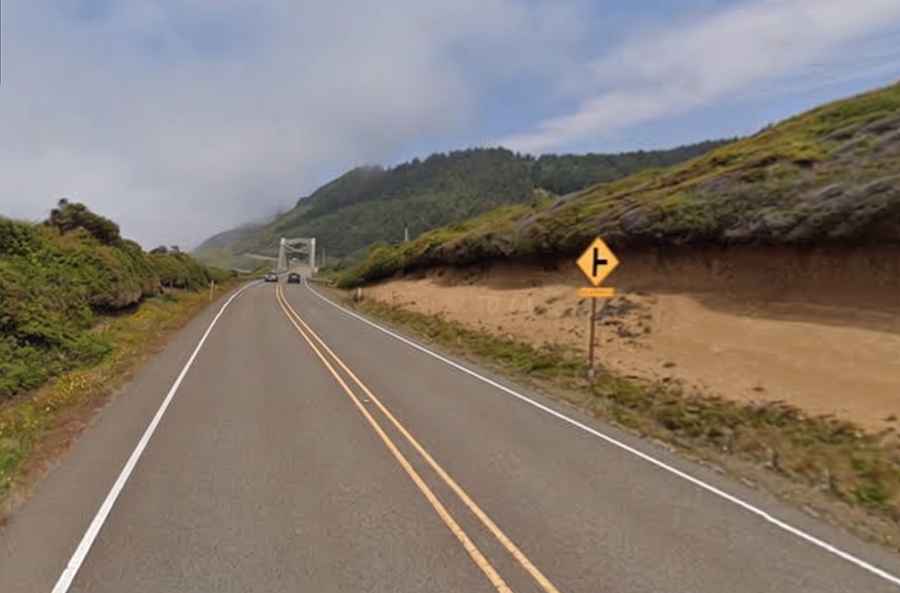
| Road facts: U.S. Route 101 (Oregon Coast Highway) | |
|---|---|
| Location | Clatsop, Tillamook, Lincoln, Lane, Douglas, and Curry Counties, Oregon (USA) |
| Route Designation | U.S. Route 101 (Oregon Coast Highway No. 9) |
| Distance | 584 km (363 miles) |
| Start / End Points | Astoria (Washington Border) to Brookings (California Border) |
| Highest Bridge Structure | Thomas Creek Bridge (105 m / 345 ft deck height) |
| Surface | Fully paved asphalt (100% paved) |
| Key Hazards | Winter landslides, ocean cliff drop-offs, dense coastal fog, narrow arch bridges |
Where is U.S. Route 101 located?
The highway follows the entire western edge of Oregon, squeezed between the Oregon Coast Range mountains to the east and the Pacific Ocean coastline to the west. It runs north to south through all six coastal counties: Clatsop, Tillamook, Lincoln, Lane, Douglas, and Curry.
Where does U.S. Route 101 start and end?
The route starts at the northern tip of Oregon in Astoria (Clatsop County), where the Astoria-Megler Bridge crosses the Columbia River from Washington State. It runs south along the Pacific coastline for 363 miles, terminating at the California state line just past Brookings (Curry County), where the asphalt continues toward Crescent City.
Is U.S. Route 101 fully paved?
Yes. U.S. Route 101 in Oregon is 100% paved across its entire length of 584 kilometers (363 miles), maintained by the Oregon Department of Transportation (ODOT). It operates primarily as a primary two-lane highway, expanding to four lanes or adding climbing passing lanes through urban zones and steep headlands.
Is U.S. Route 101 dangerous to drive?
U.S. Route 101 is not an off-road 4x4 track, but it presents real physical hazards. Basalt cliffs along the Oregon Coast Range suffer severe erosion from winter rain and ocean waves, causing frequent landslides that bury or undercut the pavement at Neahkahnie Mountain and Beverly Beach. At the Cape Perpetua sector, the asphalt clings to narrow, unshielded cliffs 240 meters above the sea with direct vertical drop-offs. Additionally, sudden coastal fog drastically reduces visibility, autumn/winter gales cause frequent hydroplaning, and narrow 1930s McCullough arch bridges (such as Yaquina Bay Bridge) force large trucks and RVs to drift into oncoming lanes through sharp 90-degree entry turns.
How long does it take to drive U.S. Route 101 along the Oregon Coast?
Driving the full 363-mile stretch between Brookings and Astoria takes roughly 7.5 hours of continuous driving without stops. This baseline travel time does not account for real-time traffic bottlenecks, summer congestion, or seasonal roadwork closures along coastal headlands.
To navigate the route properly, split the transit over a minimum of 3 full days. Spacing out the mileage accounts for steep mountain grades, single-lane passing delays, and access stops at lighthouses, trailhead parking, and coastal view pullouts.
How busy is traffic and what are the speed limits on U.S. Route 101 in Oregon?
Speed limits vary based on terrain and urban density. Open rural stretches carry a maximum limit of 55 mph (88 km/h). Passing through coastal towns drops the speed limit to 25–35 mph (40–56 km/h). Twisting cliffside sections with sharp curves and unshielded drop-offs drop the recommended speed to 45 mph (72 km/h) or lower.
Traffic remains light to moderate along open rural headlands, where designated passing lanes allow vehicles to overtake slower trucks. However, heavy congestion builds up inside coastal towns during peak summer months, where narrow two-lane corridors funnel local traffic, RVs, and pedestrians into tight bottlenecks.
Is U.S. Route 101 worth the drive?
It is one of the most visual and technically interesting coastal highways in North America, connecting ocean and mountain terrain in a continuous line of sight. The route features vertical basalt cliffs towering over 200 meters above the ocean, over a dozen 1930s historic steel and concrete arch bridges designed by engineer Conde McCullough (including Thomas Creek Bridge, suspended 105 meters above a canyon), dense old-growth Sitka spruce rainforests reaching the beach, and direct access to ocean sea stacks like Haystack Rock, Heceta Head lighthouse, and marine blowholes like Thor's Well.