How to drive high-mountain AZ-366 Road in Arizona?
Arizona State Route 366 (AZ-366) is a high-mountain winding road, with sharp curves and no guardrails, located in Graham County, in the U.S. state of Arizona. It tops out at 2,936m (9,632ft) above sea level near Mount Graham.
| Road facts: Arizona State Route 366 (AZ-366) | |
|---|---|
| Location | Graham County, Arizona, USA |
| Max Elevation | 2,936 m (9,632 ft) |
| Length | 46 km (28.3 miles) |
| Surface | 35 km paved / 11 km rough gravel and dirt |
| Vehicle Restriction | Strictly limited to vehicles under 40 feet in length |
Where is Arizona State Route 366?
The road, locally known as Swift Trail Parkway, is located in the southeastern part of Arizona, within the Coronado National Forest. The drive provides expansive views across the desert floor. AZ-366 was established as a State Highway in 1960.
How long is Arizona State Route 366?
The road is 46km (28.3 miles) long, running east-west from Swift Trail Junction (on the paved US-191 Road) to the Columbine Ranger Station. At this point, the road continues as Forest Road 803 and leads to Riggs Flat Lake, where the drivable track ends.
Is Arizona State Route 366 paved?
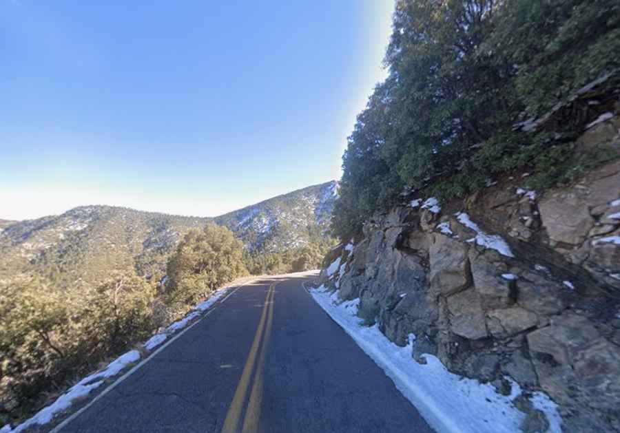
The first 35 kilometers (21.6 miles) of the road are fully paved, starting on US-191, south of Safford. This section climbs rapidly from the desert floor through a series of steep switchbacks. At Turkey Flat, the pavement cuts through a sequence of five sharp hairpin turns. The pavement ends near the Boy Scout Camp Road junction, leaving the final 11 kilometers (7 miles) as a rough gravel and dirt track that terminates at the Columbine Ranger Station. The final part of the road requires a high-clearance vehicle due to deep ruts, loose rocks, and washboard surfaces.
How challenging is driving Arizona State Route 366?
The road features severe vertical drops with no protections. It comprises many curves and hairpin turns. It is strictly limited to vehicles under 40 feet in length due to its steepness and the numerous switchbacks all the way. The route lacks guardrails for almost its entire length. Along the way, you will cross a narrow, single-lane stone bridge over Wet Canyon.
Is Arizona State Route 366 closed during the winter?
Set high in the Pinaleño mountain range, it's one of the highest roads in Arizona. The unpaved high-altitude section of the highway is subject to a strict seasonal closure between November 15 and April 15. Heavy snowfall, black ice, and sub-freezing temperatures make the gravel ridge impassable for standard vehicles. During the summer monsoons, the road is also prone to sudden closures due to flash floods, landslips, and severe wildfire risks.