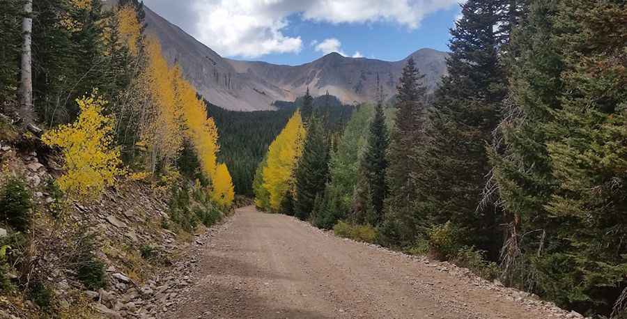
Driving the steep Forest Road 4717 to South Mountain in Utah
South Mountain is a high mountain peak at an elevation of 3,258m (10,688ft) above sea level, located in San Juan County, in the US state of Utah. It is one of the highest roads in Utah.
| Road facts: South Mountain (Forest Road 4717) | |
|---|---|
| Location | San Juan County, Utah (USA) |
| Max Road Elevation | 3,258 m (10,688 ft) |
| Length | 4.82 km (3.0 miles) |
| Average Gradient | 11.8% |
| Surface | Unpaved, narrow, and eroded gravel |
Is the road to South Mountain in Utah unpaved?
The road to the summit is totally unpaved. It’s called Forest Road 4717. The road is narrow and heavily eroded. The surface is a mix of loose gravel and rocks that have been carved by years of harsh winters and snowmelt.
How long is the road to South Mountain in Utah?
Starting from the junction with Forest Road 0128, the road to the summit is 3.0-mile long. Over this distance, the elevation gain is 1,870 feet and the average gradient is 11.8%. A high-clearance 4x4 vehicle is required.
Is the road to South Mountain in Utah open year-round?
Set high in the La Sal Mountains, the road is usually impassable during the winter months due to heavy snow. Even in summer, the weather in the La Sals can change in minutes; a sudden storm can make the steep descent extremely dangerous as the gravel becomes slick.
Pic: Cecil Tuley