How steep is the 4x4 road to Uncompahgre Butte?
Uncompahgre Butte is a high mountain peak at an elevation of 2,955m (9,694ft) above sea level, located in Mesa County, in the US state of Colorado. The summit is reached via a short but brutal 1.6 km spur that branches off the Divide Road on the Uncompahgre Plateau.
| Road facts: Uncompahgre Butte | |
|---|---|
| Location | Mesa County, Colorado (USA) |
| Elevation | 2,955 m (9,694 ft) |
| Length | 1.6 km (1 mile) |
| Surface | Unpaved / Volcanic Rock and Dirt |
How is the climb to Uncompahgre Butte?
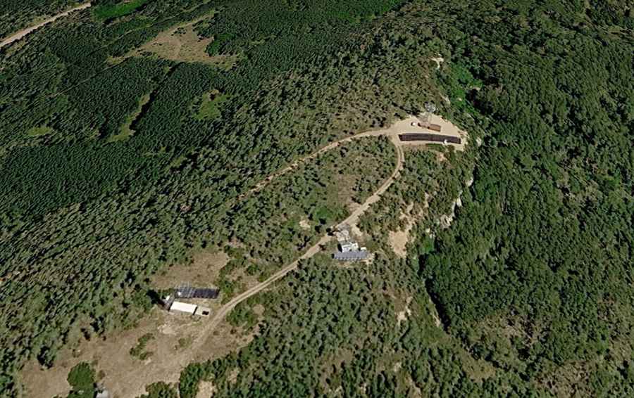
The 1.6 km climb is a steep, unmaintained service track designed for radio tower maintenance, not for public traffic. It gains nearly 100 meters in a very short distance, with ramps reaching a 10% gradient. The surface is littered with embedded volcanic rocks and deep ruts that will catch the underbody of any car without high clearance. You need a 4x4 with low-range gearing to manage the traction on the loose, uneven soil. It is a dead-end road that finishes at a cluster of antennas and technical buildings.
What are the hazards at the Uncompahgre Butte summit?
The summit is a maze of radio towers and steel guy-wires that anchor the antennas. Space at the top is extremely tight; if there is a maintenance truck parked there, you will have to reverse down a significant portion of the steep track because there is no room to turn around. The area is also highly exposed; as the highest point on the ridge, the peak is a lightning magnet during the frequent afternoon storms of the Colorado Plateau. The edge of the road is unprotected, and a single mistake in wheel placement can send the vehicle down a steep embankment.
How does the weather affect the road to the Butte?
The road is impassable for most of the year. Snow buries the track from late October until at least June. Even in summer, the biggest danger is the "adobe mud." The soil on the plateau turns into a thick, sticky grease when wet that clogs tire treads instantly. Steering becomes impossible and the vehicle will slide off the road even on minor inclines. If it starts to rain while you are at the summit, you need to get down immediately before the dirt turns into a trap.