How to drive the unpaved NF-2150 road to Aldrich Mountain in Oregon?
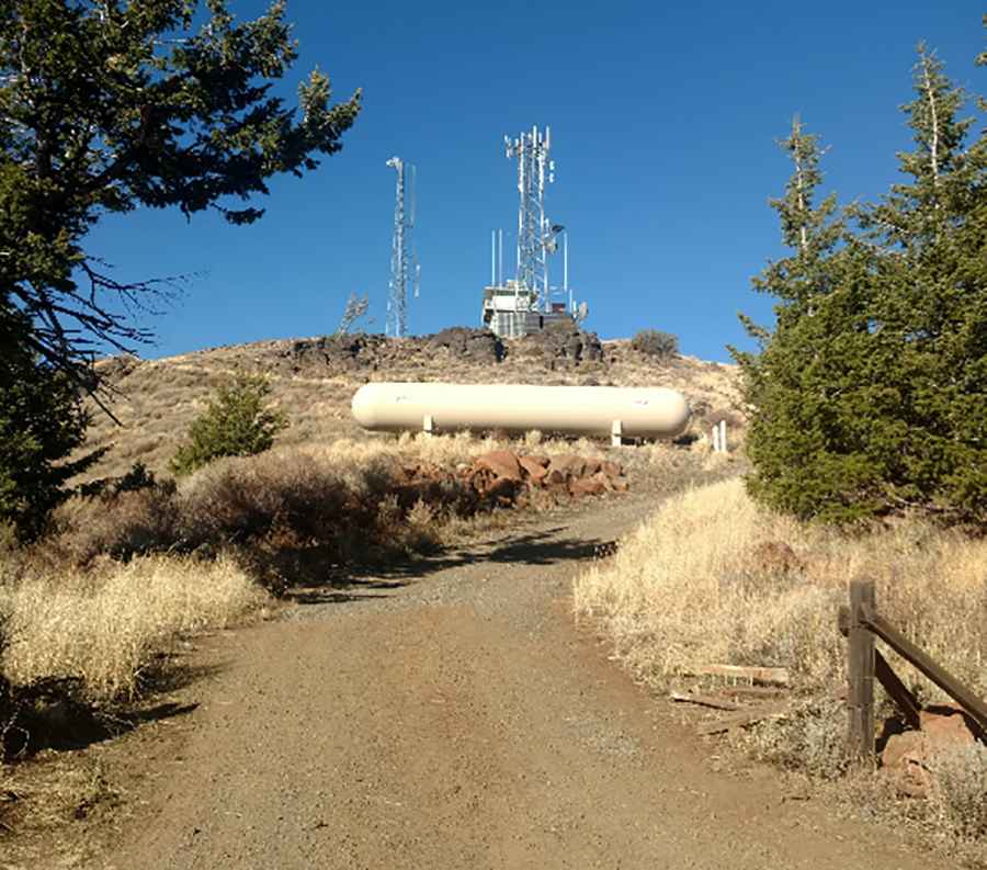
Aldrich Mountain is a high-altitude peak reaching 2,127m (6,978ft) above sea level, located in Grant County, Oregon. Tucked away in the Malheur National Forest, the summit is home to an active fire lookout. Accessing the top requires driving the Forest Service Road 2150 (NF-2150), a remote and unpaved track that demands mechanical self-sufficiency and caution due to its isolation in the central Oregon wilderness.
| Road facts: Aldrich Mountain (NF-2150) | |
|---|---|
| Location | Grant County, Oregon (USA) |
| Elevation | 2,127 m (6,978 ft) |
| Road Number | Forest Service Road 2150 |
| Length | 14.5 miles (23.3 km) |
| Surface | Unpaved (Gravel / Dirt / Loose rocks) |
Where is the road to Aldrich Mountain?
The peak, part of the Aldrich Mountain range south of Dayville, is reached via the NF-2150 road. Logistically, the drive starts at the junction with NF-21 and climbs steadily through open rangeland and thick timbered slopes. This 14.5-mile sector is part of the Blue Mountains region, where the roadbed is maintained primarily for Forest Service fire monitoring and local ranching logistics. There are no services or mobile signals once you leave the main valley, making fuel management critical before heading out of Dayville.
Is the NF-2150 road to Aldrich Mountain dangerous?
Technically, the road is unpaved and composed of a mix of gravel and native dirt. While it may seem manageable in dry conditions, the hazards increase rapidly near the final summit ridge where the track becomes significantly narrower and steeper. Drivers must watch out for heavy washboarding and sudden loose rocks that can compromise traction. Logistically, the main threat is the unpredictable high-altitude weather; a sudden thunderstorm can turn the dirt surface into a slick, muddy trap, especially in the shaded timber sections where the ground stays soft until late June.
Mechanical requirements for the 6,978ft lookout climb
Reaching the Aldrich Mountain Lookout involves a sustained 14.5-mile climb that puts a constant load on the vehicle's cooling system. Technically, high-clearance is necessary to avoid undercarriage damage from protruding rocks or deep ruts. During the descent, engine braking is required to prevent brake overheating on the long gravel ramps. Logistically, this road is often blocked by downed trees after high winds, and maintenance crews may take weeks to clear it. Carrying a chainsaw, a full-sized spare tire, and an emergency kit is a technical necessity for anyone driving this remote sector of the Malheur National Forest.
When is the best time to drive to Aldrich Mountain?
At nearly 7,000 feet, the road is impassable during winter and remains blocked by deep snow until at least June. Technically, the optimal logistical window is from July through September, when the roadbed is dry and the fire lookout is staffed. Even in summer, the presence of elk and deer on the roadbed is a constant hazard, requiring a slow pace to manage the blind turns through the forest. Always check local Forest Service conditions before attempting the 14.5-mile transit to ensure the NF-2150 is clear of debris and accessible.
Pic: Toby Harrison