Dutchman Peak: Driving to the historic 1927 lookout in Oregon
At an elevation of 2,243m (7,358ft) above sea level, Dutchman Peak is a high mountain summit in the Siskiyou Mountains of Southern Oregon. Located within the Rogue River-Siskiyou National Forest near the California border, the peak is home to one of the oldest fire lookouts still in service in the United States.
| Road facts: Dutchman Peak | |
|---|---|
| Location | Jackson County, Oregon, USA |
| Elevation | 2,243 m (7,358 ft) |
| Road Name | Road 800 (Dutchman Peak Road) |
| Length | 2.1 km (1.3 miles) |
| Avg Gradient | 5.42% |
Where is Dutchman Peak?
The peak, also known as Dutchman’s Peak, is located in Southern Oregon, very close to the California border. It sits on the Siskiyou Crest, between the Rogue Valley and the Klamath River Basin. The terrain is a mix of high meadows and rocky ridges, typical of the Rogue River National Forest area.
What’s at the summit of Dutchman Peak?
The summit features one of the last original cupola-style fire lookouts built in 1927. It is one of the oldest lookouts remaining in service in the country. While technology has changed fire detection, this structure is still used during emergencies and is often staffed by volunteers or forest personnel during the summer fire season.
Is the drive to Dutchman Peak worth it?
On a clear day, the summit offers 360-degree views of the region. You can see across a large part of Southern Oregon and look south to the silhouette of Mount Shasta in California. It is a great spot to see the entire Siskiyou mountain range from a single point.
Is the road to Dutchman Peak unpaved?
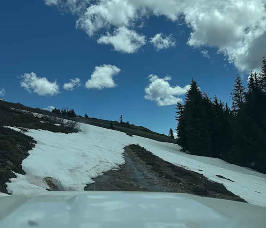
The road to the summit is totally unpaved. It is called Road 800 (or Dutchman Peak Road) and is fairly steep and rocky for the last few miles. You will encounter 10-inch rocks that can easily damage a standard car or puncture tires. A 4WD or AWD vehicle with high clearance is recommended. The road is narrow, slanted, and has no guardrails.
How long is the road to Dutchman Peak?
Starting from the NF-20 Road, the climb to the summit is 2.1 km (1.3 miles) long. The elevation gain is 114 meters with an average gradient of 5.42%. There is a gate near the end of the road; you will likely have to park there and walk the final half-mile to reach the lookout at the top.
What should I keep in mind before driving to Dutchman Peak?
There is no mobile service and no facilities at the peak, so download your maps for offline use before you go. Do not attempt this road after the first snow, as the track becomes impassable quickly. Check your spare tire before starting the climb, as the rocks on Road 800 are sharp and known for causing flats.
Is the road to Dutchman Peak open in winter?
No, the road is usually blocked by snow from late October through June. At over 7,000 feet, the Siskiyou Crest receives heavy snowfall that makes Road 800 impossible to drive. Always contact the local Ranger Station in Applegate to check road conditions before planning a trip in early summer or late fall.
Pic: cassie dunn