Plum Island: The forbidden federal roads of Fort Terry
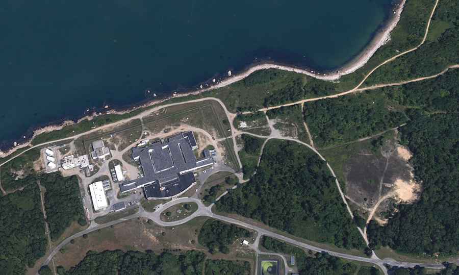
Plum Island is a strictly restricted federal enclave located in the Long Island Sound, off the North Fork of Suffolk County, New York. While the island features a complete network of paved and service roads, public access is absolutely prohibited by federal law. Managed by the Department of Homeland Security (DHS), the island serves as a high-security quarantine zone, housing the Plum Island Animal Disease Center (PIADC). The roads here are not for transit, but for the heavy logistics of bio-containment and the maintenance of a high-security national asset.
| Road facts: Plum Island | |
|---|---|
| Location | Suffolk County, New York (USA) |
| Status | Strictly Restricted / Federal Zone |
| Infrastructure | Paved military and laboratory service roads |
| Jurisdiction | DHS / USDA |
What is the military origin of the Plum Island road network?
The paved roads that crisscross Plum Island today have their roots in the late 19th century. From 1897 through World War II, the island was the site of Fort Terry, a massive U.S. military installation designed to defend the entrance to Long Island Sound. The ferro of this period consists of reinforced concrete roads built to transport heavy artillery and ammunition to the island's coastal gun batteries. While many of these paths are now overgrown or integrated into the laboratory's service grid, the original military-grade infrastructure remains the backbone of the island's terrestrial logistics.
How is the access to the PIADC service roads controlled?
Since 1954, the primary function of Plum Island has shifted to the study of high-consequence animal diseases, such as Foot-and-Mouth Disease (FMD). The modern service roads connect the high-containment laboratories with the dedicated ferry terminal, the island's only point of entry. The restriction is absolute; no private vehicles, unauthorized personnel, or civilian craft are permitted to land. Every meter of asphalt is monitored by federal security personnel. The logistical protocol for any movement on these roads involves multiple layers of clearance, as the risk of pathogen escape dictates a zero-tolerance policy for unregulated traffic.
What are the hazards of the Plum Island exclusion zone?
The primary hazard of Plum Island is not the road surface itself, but the biological and national security mandates of the facility. The labs handle lethal pathogens that require specialized decontamination procedures for any personnel or equipment leaving the site. The island's roads serve as a strictly controlled drive where every vehicle is part of a monitored supply chain. Unauthorized landing on the island’s shores is a federal offense, and the perimeter is patrolled to ensure that the quarantine remains unbroken. This top-tier security makes the road network one of the most inaccessible pieces of infrastructure in the United States.
What is the future of the restricted infrastructure on Plum Island?
With the planned transition of laboratory operations to the National Bio and Agro-Defense Facility (NBAF) in Kansas, the future of the Plum Island roads is currently a subject of federal debate. The existing infrastructure, including the historic Fort Terry batteries and the laboratory buildings, requires constant maintenance to prevent decay in the harsh maritime environment of the Long Island Sound. Until a final decommissioning plan is executed, the island remains a "dead end" for any driver, a network of roads existing solely within a high-security quarantine bubble that continues to be off-limits to the general public.