San Miguel Island: Military service tracks and UXO hazards
San Miguel Island, the westernmost of the Channel Islands in California, features a unique network of unpaved service tracks within a high-risk environment. Established during the U.S. Navy's tenure (1930s–1970s) when the island served as a bombing and gunnery range, these tracks were built for military logistics. Today, the island remains a high-security zone managed by the National Park Service, where the presence of Unexploded Ordnance (UXO) makes driving and even walking a strictly regulated activity.
| Road facts: San Miguel Island | |
|---|---|
| Location | Channel Islands, California, USA |
| Main Route | 13 km (8 miles) to Point Bennett |
| Hazard Level | Extreme (UXO / Unexploded Ordnance) |
| Access | Authorized NPS Vehicles Only |
Where are the service tracks of San Miguel Island?
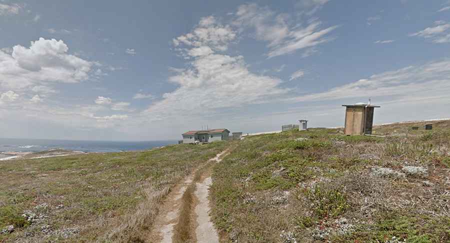
The island is located in the Pacific Ocean, off the coast of Santa Barbara. The primary service track spans 13 kilometers (8 miles) round-trip, crossing the central plateau from the Ranger Station near Cuyler Harbor to Point Bennett at the western tip. This is a desolate environment, completely exposed to relentless northwest winds and thick fog. There are no paved sections; the entire network consists of raw dirt and sand paths that follow the ridge of the island.
How dangerous are the UXO zones on San Miguel?
The island was a primary target for aerial bombing and naval gunfire for decades. Because of this, the ground is littered with Unexploded Ordnance (UXO). These military munitions can be hidden just beneath the surface or exposed by wind erosion. It is illegal and life-threatening to leave the designated service tracks. Public access is only permitted with a certified Ranger escort, and every individual must sign a legal liability waiver before entering the track system due to the risk of accidental detonation.
Is motorized transit allowed on San Miguel Island?
No public motorized vehicles are allowed on the island. The only vehicles permitted are specialized National Park Service (NPS) off-road equipment used for administrative logistics, maintenance, and wildlife research. All other transit must be done on foot, strictly following the escorted military tracks. The isolation is total; if a vehicle breaks down or a person is injured, rescue depends entirely on boat or helicopter transport from the mainland, which is often delayed by extreme sea conditions.
Why are the tracks on San Miguel Island eroding?
The tracks are subject to rapid erosion because of the island's unique geology and lack of vegetation. In areas like the "Caliche Forest," the soil is composed of ancient calcium carbonate casts that turn into fine, unstable dust when disturbed. Constant wind stripping and heavy winter rains create deep ruts and washouts on the service paths. Maintaining these tracks is a constant struggle to prevent the island's fragile topsoil from blowing into the ocean while keeping a safe corridor through the ordnance-heavy zones.
Who built the road system on San Miguel Island?
The infrastructure was built by the U.S. Navy to monitor impact zones and move equipment across the island. The tracks were designed for rugged military trucks and were never intended for civilian use. Today, these paths are the only way to reach the massive pinniped rookeries at Point Bennett without disturbing the wildlife or entering live fire zones. The "road" is essentially a historical military scar that serves as the only safe terrestrial link across this high-risk volcanic outpost.