Is the road to Lucky Strike Mine in Utah’s San Rafael Swell dangerous?
Lucky Strike Mine is a forgotten uranium and vanadium ghost town tucked away at 1,771m (5,810ft) above sea level in Emery County, Utah. Located in the heart of the San Rafael Swell, specifically within the rugged Reds Canyon area, this site is a relic of the 1950s uranium boom. Driving to the mine is more than a scenic trip; it is an entry into a remote, unmonitored desert environment where the road surface, the lack of communication, and the lingering radiation from the old shafts create a high-stakes adventure for any off-road driver.
| Road facts: Lucky Strike Mine | |
|---|---|
| Location | San Rafael Swell, Emery County (Utah) |
| Elevation | 1,771 m (5,810 ft) |
| Road Length | 1.44 km (0.9 miles) from Reds Canyon Rd |
| Surface | Unpaved / Red Dirt / Sand |
| Hazards | Radiation, Flash Floods, Extreme Isolation |
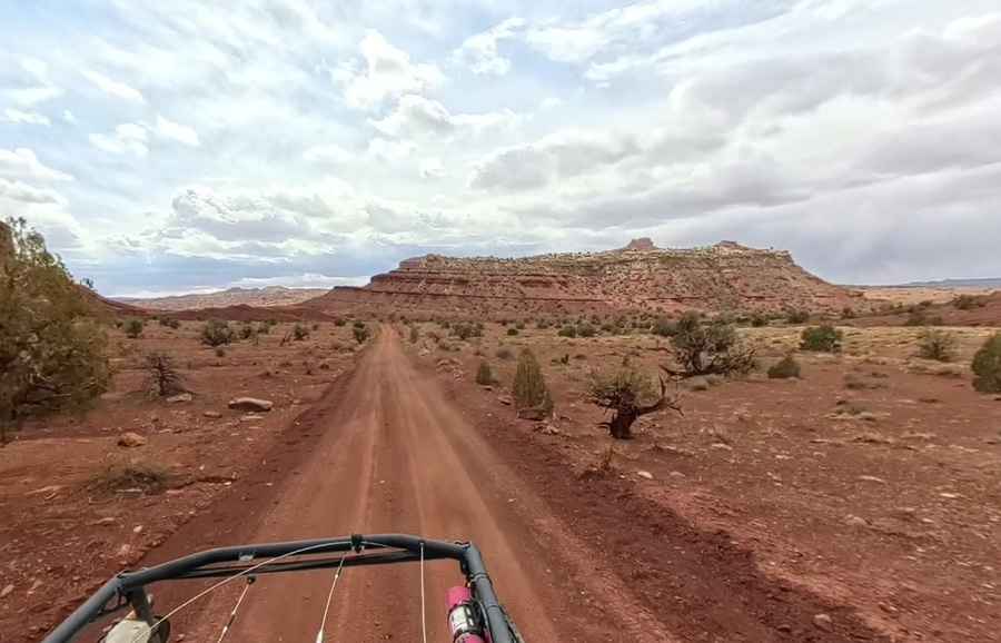
How is the unpaved road to Lucky Strike Mine?
The road to the mine is a 1.44 km (0.9 miles) spur off the already remote Reds Canyon Road. While the track is graded, it consists entirely of the characteristic red dirt of the Swell, which can change consistency in seconds. High clearance is mandatory; even if the road appears flat, the deep ruts and the occasional sandy wash can easily trap a standard 2WD car. The journey requires a vehicle capable of handling "moody" weather, as even a minor storm can turn the fine desert dust into a thick, red clay that makes steering nearly impossible and clogs the undersides of the car.
What are the radiation risks at Lucky Strike Mine?
Unlike other ghost towns in Utah, Lucky Strike carries a hidden hazard: residual radiation. As an abandoned uranium mine from the mid-20th century, the decaying cabins, shacks, and storage sheds are surrounded by tailings and open shafts that still emit radon gas and radiation. Driving through the canyon floor means kicking up dust that may contain radioactive particles. Entering the mine shafts is strictly discouraged, as they are structurally unstable and concentrated pockets of radiation can be lethal. This is a site where you must stay on the track and avoid any unnecessary contact with the old mining waste scattered across the canyon floor.
Why is the San Rafael Swell a high-risk driving zone?
The isolation of the Reds Canyon area is total. There are no services, no water, and zero cellular signal for dozens of miles. If your vehicle breaks down or you run out of fuel, you could spend days without seeing another soul. You must have at least 100 miles of off-road fuel capacity before entering the Swell. The canyons are also prone to sudden flash floods; a storm 20 miles away can send a wall of water through the canyon floor in minutes, washing away the road to Lucky Strike and leaving you stranded between the towering sandstone walls.
What is the best time to drive to Lucky Strike Mine?
The best window for the drive is during the dry months of late spring or early autumn. You must avoid the area during and immediately after heavy rain, as the unpaved roads become treacherous and the washes become impassable. The heat in the peak of summer can also be a mechanical hazard, leading to engine overheating on the slow, low-gear crawls through the sandy sections. Always carry extra food, several gallons of water, and a physical map, as electronic navigation often fails in the deep shadows of the sandstone cliffs where GPS signals are blocked.
Pic: Chris Reed