Safety Guide: Driving the Highest Passes in the US
America’s loftiest roads are gorgeous and unforgiving. Grades run long, shoulders stay narrow, and the air gets thin enough to bother engines and people. If you’re aiming for Colorado fourteeners or western summit byways, a little planning turns a white-knuckle climb into a day you’ll actually enjoy.
Where the risk really lives on high passes
Elevation changes everything. Above roughly 10,000 feet, less oxygen can nudge judgment, stamina, and sleep off course. That’s not drama; it’s physiology covered plainly in the CDC’s high-altitude travel guidance. Even mild symptoms—headache, lightheadedness, odd fatigue—can make a tricky descent feel trickier. Geometry piles on. Long downgrades stack heat into brakes, off-camber curves punish sloppy lines, and late-afternoon frost pockets appear in shadowed cutbanks even on sunny days. The fix is mechanical sympathy: lower gears, smooth inputs, and longer following distances than you’d ever leave on the flats.
Engines feel the altitude too. Naturally aspirated cars lose power; turbocharged ones hold more, which can tempt you into speeds your brakes won’t love. Cooling systems work harder because thin air sheds heat poorly. If your coolant, pads, or tires are already marginal at sea level, the mountain will find them. Before a big day, verify tread depth and pressures, confirm pad life and fluid condition, and make sure your spare is properly aired. It’s quiet insurance.
A quick plan before you point uphill
Treat “highest pass” days like light mountaineering. Sleep higher the night before if you can, or build pauses into the climb so your body catches up. Hydration beats late caffeine by a mile. If anyone develops a stubborn headache, dizziness, or odd shortness of breath, swap drivers, drop some elevation, and regroup. That one decision preserves trips. Sun is stronger up high, so bring sunglasses that cut glare on pale chip-seal and snow patches. Snack early and often; low blood sugar masquerades as nerves.
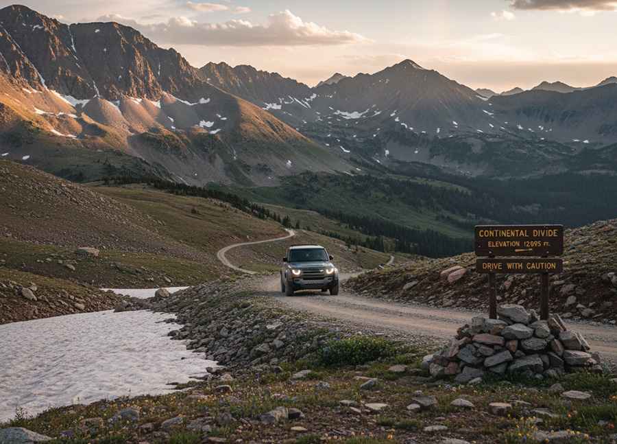
For route homework, lean on on-the-ground notes. Our profiles of Colorado’s Mount Evans Scenic Byway and classic 4x4 routes like Imogene Pass flag surface, lane width, and seasonality the map won’t show. If you want the big picture first, the roundup of the Highest Roads of the United States gives altitudes and typical opening windows so you’re not guessing.
Two quick case studies you can copy
On Mount Evans, the descent from Summit Lake is where visitors cook brakes. The successful pattern is almost boring: select a low gear at the first sign of downgrade, settle into 20–25 mph, and use long sightlines to keep your foot off the pedal. If you smell lining, pull into a turnout and let things cool. Ten minutes of patience beats glazed rotors and a tow.
On Imogene Pass, the hazard isn’t speed, it’s momentum management on embedded rock. Drivers who keep a steady throttle and pick clean lines through baby-heads avoid wheelspin and sidewall cuts. Those who rush the ledges or brake hard on loose shelves end up backing for a second try on exposure. Calm inputs and tires aired to the mid-teens PSI for 4x4s make a huge difference; re-inflate before returning to pavement.
Braking and gearing: the “quiet hands” approach
What cooks brakes on high passes isn’t speed—it’s heat you never let out. Use engine braking on the way down, even in automatics; tow/haul modes hold gears longer for exactly this reason. Pick a lower gear than feels natural and let the drivetrain do the heavy work. Keep your footwork patient, pulse-brake if speed creeps up, and give yourself room to spot decreasing-radius turns. If you catch the faint whiff of brake lining, you’re already late. Pull into a turnout, pop the hood to vent heat, and wait until the smell fades. Resist the urge to set the parking brake; hot pads can imprint on hot rotors and add vibration you’ll fight the rest of the trip.
Runaway truck ramps exist because physics wins. If you ever feel the pedal go long despite downshifts, do what professionals do: hold a predictable line, signal early, and use the ramp. Pride is cheaper than metal.
Winter traction and chain rules you actually need
In the Rockies and Sierra, “open” doesn’t mean “easy.” States can flip traction and chain requirements on with little notice. Colorado is the bellwether: Colorado DOT’s traction and chain laws allow activation on any state highway. When they’re on, your vehicle needs winter-rated tires with adequate tread, an approved traction device, or chains depending on the rule in effect. Status changes fast during shoulder seasons, so check conditions the morning you drive and make sure your kit matches the rule before you leave the lot.
A short RV example helps. On late-September mornings along the Front Range, passes can swing from dry to a brief snow squall and back. Coaches with long overhangs and towed cars need longer gaps for weight transfer and a gentler hand on descents. Drop a gear sooner than you think and avoid sudden corrections around bridge decks and shaded rock cuts. When chain control activates, don’t gamble on “just one more mile”; pulling over in a legal area with firm footing is safer than trying to suit up on a sloped shoulder.
Passing etiquette, turnouts, and small markers that matter
Everyone’s working at their limit—tourists framing photos, locals just getting to work, cyclists grinding at eight miles an hour. Keep right where it’s safe, use pullouts generously, and don’t slingshot past a queue only to stop in the next curve for a snapshot. Signal early, complete passes cleanly on signed zones only, and remember that motorcycles and bicycles experience cross-winds as body checks. At some overlooks you’ll notice understated plaques honoring crews or marking history. Durable metal markers—often commemorative bronze plaques—hold up to altitude, freeze-thaw, and strong UV without becoming maintenance headaches. They’re a quiet reminder that these roads were carved inch by inch; give crews and other drivers the space you’d want in their shoes.
Weather windows, shoulders, and the human factor
High passes write their own forecasts. Afternoon convection can pop hail and lightning on a blue-sky day, and monsoon season pushes fast-moving cells that turn gravel into grease. Start earlier than you think so you’re descending when storms build. Park only in marked pullouts or signed overlooks; soft shoulders near the crown can collapse, and nothing ruins a view like a stuck axle. Bring layers even in July; windchill at 12,000 feet isn’t a figure of speech.
Altitude etiquette extends inside the car. If anyone goes quiet or oddly irritable, that can be a fatigue flag. Share the wheel, keep conversation light, and don’t let a schedule push you past your margins. The best photos usually come from the stop you almost didn’t take.
When to call it, and how to salvage the day
There’s no shame in turning around. If weather’s marching in, your co-pilot looks gray, or you’ve already cooked a set of pads, pick a lower scenic road and save the summit for a clearer window. You’ll still get the views—just from a safer angle—and you’ll keep your rig ready for the next attempt instead of warming a shop bay. On some corridors, a half-day pivot to a lake or valley road scratches the itch without the risk.
Driving the highest passes in the US, without the drama
If you remember one thing, make it this: start earlier than you think, gear down sooner than you feel, and listen to both the road and the people in your car. The highest passes in the US reward patience. With a modest plan, a little altitude sense from the CDC’s high-altitude guidance, and respect for Colorado’s traction rules that keep corridors moving, you’ll end up with a day that lives in your photo book, not an incident report. And when you stop at that windswept overlook near the top, take a minute for the small marker. Someone spent a winter up there so you could make the drive.