Apache Trail is one of the most beautiful drives of Arizona
Apache Trail is a scenic desert drive located in the south-central part of the U.S. state of Arizona, often considered one of the most picturesque routes near the Phoenix area.
How long is Apache Trail?
Spanning Gila, Maricopa, and Pinal counties, the road, also known as State Route 88 or AZ88, stretches for 62 km (39 miles), running from Apache Junction in the Greater Phoenix area to Theodore Roosevelt Lake. The majority of the road maintains a maximum speed limit of 15 mph. General Motors Proving Grounds' test drivers utilized Apache Trail to test tires and vehicle maneuverability.
When was Apache Trail built?
Nestled high in the Superstition Mountains, the scenic road was constructed in 1904 to provide construction access for the Roosevelt Dam, which was completed in 1911.
Is the Apache Trail AZ open?
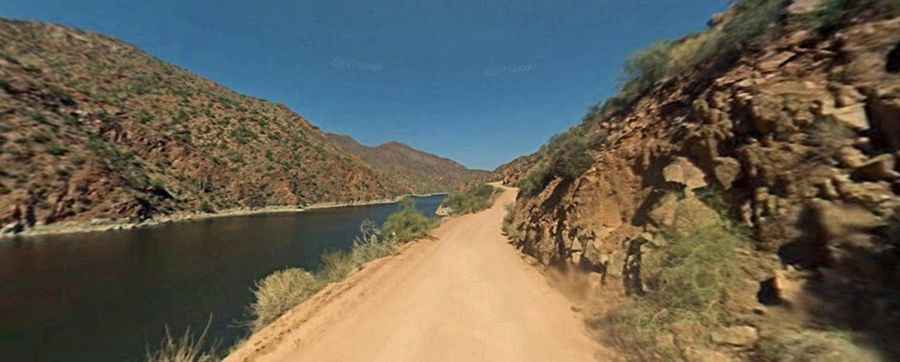
Hidden within the Tonto National Forest, this scenic desert drive remains open year-round, winding through canyons, geologic formations, desert plants and trees, offering captivating views of the desert and the lake. However, since 2019, parts of the road have been mostly closed due to landslides, fires, and floods. Some sections, such as the stretch between Fish Point and the Apache Lake Marina, are completely closed, while others are open to foot traffic only, from the marina to Roosevelt Dam.
Is Apache Trail paved?
The road is mostly unpaved, with some asphalt sections. It’s navigable by most passenger vehicles and winds steeply through rugged desert mountains. The road was named after the Apache Indians who originally used this trail.
Is it safe to drive the Apache Trail?
A traveler on this road must be experienced and completely devoted to safe, slow, and obstacle-conscious driving to deter danger. Some passengers may think that the drive up is a bit easier than the drive back with steep cliff drops and little in the way of safety barriers. On the way up, although the turns are tight and the road is narrow, at least you have the mountain on your side, not the cliff. Obviously, if you turn around and go back the way you came, your return trip might be a bit more harrowing. Note to the driver: keep your eyes on the road, not the scenery. The road is known for its dizzying, narrow road, with drops in some areas of more than 1,000 feet (304m). With such drops, the path can turn deadly. The trail requires caution when driving and is not recommended for large RVs, SUVs, or caravans. Some large RV rental companies in the US do not allow their vehicles to be taken on this route. Certain parts of the trail are susceptible to flash flooding.
How long does it take to do the Apache Trail?
To drive the road without stopping will take most people between 1.5 and 2 hours. This well-traveled road runs through some of the most awe-inspiring country in Arizona and affords visitors incredible views. If you enjoy driving, it is a fun trip. If you don't like to drive, don't do it. Springtime is beautiful, especially if wildflowers are in bloom. When it starts to get hot, this can be a nice day trip if your car's air-conditioning is working well. Your stops to get out of the car will just be shorter. The downside to taking this scenic drive in the summer is lake traffic, camping traffic, and the possibility of breaking down in the Arizona heat. The road travels through magnificent scenery of twisted igneous mountains with dense forests of saguaro and ferocactus, and several deep blue lakes.