Ranchos Peak: Driving the rough logging roads of Taos
Ranchos Peak is a high-altitude mountain summit located in Taos County, in the US state of New Mexico. Located within the Carson National Forest, the track leading to the peak is a raw, unpaved logging road that climbs the Sangre de Cristo Mountains, forcing vehicles to cross 8.7 kilometers of deep mud ruts, sharp rocks, and unstable high-desert soil.
| Road facts: Ranchos Peak | |
|---|---|
| Location | Taos County, Northern New Mexico, USA |
| Elevation | 2,851 m (9,353 ft) |
| Distance | 8.7 km (5.4 miles) from US-64 |
| Max Gradient | Over 10% on dirt switchbacks |
| Vehicle Required | Strictly high-clearance 4x4 with low range |
Where does the logging road to Ranchos Peak start?
The unpaved mountain track begins right off the paved US-64 highway, just east of the town of Taos. From the turn-off, the lane plunges into a confusing maze of mountain dirt paths used by forestry crews. This sector borders the tribal lands of the Taos Pueblo. Driving off the main Forest Service track is dangerous because trespassing on these protected tribal territories is completely banned, and there are no signs or fences to warn you when you cross the border line.
Why do you need a heavy 4x4 to climb Ranchos Peak?
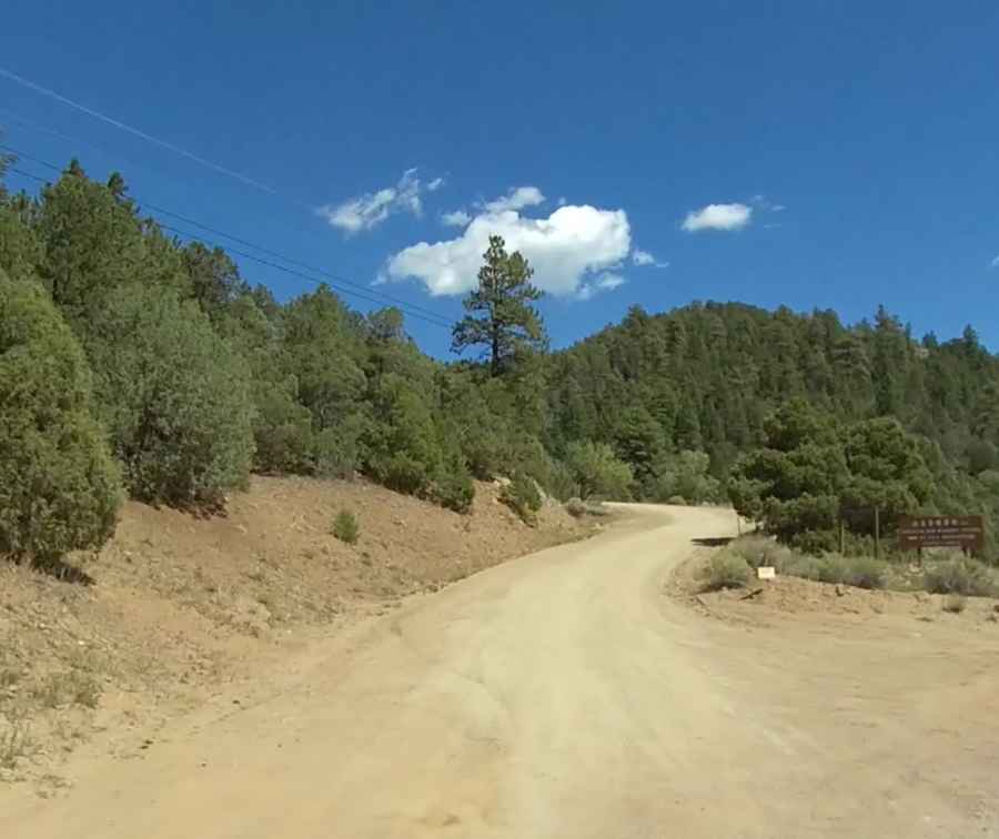
The route is an active timber extraction track, meaning the surface is continuously ripped up by heavy logging machinery and tracked vehicles. The dirt lane is gouged with deep, solid ruts that will instantly high-center a standard car, smashing the oil pan or ripping off the exhaust pipe on the high central ridges. The soil here contains a high amount of caliche clay; when a sudden rain shower hits the mountain, the dirt turns into a slick, grease-like slime that clogs tire treads and makes traction impossible without a four-wheel-drive system and deep all-terrain tires.
How steep are the dirt ramps on Ranchos Peak?
The 8.7-kilometer climb gains 474 vertical meters from the valley floor to the summit. While the average slope sits at a moderate 5.44%, the logging design means the road cuts straight up the mountain face, hitting sudden pitches that exceed 10% on loose earth.
What infrastructure dangers exist on the Ranchos Peak road?
This is an utility track built with zero comfort or safety features in mind. The route lacks any steel guardrails, concrete side barriers, or retaining walls, leaving the narrow outer edge open to steep drops over the forest gulches. The lane narrows significantly as it cuts through dense timber blocks, where fallen tree trunks or deep washouts caused by melting snow frequently block half the driving path, leaving barely enough width for a single vehicle to pass through.
Can you drive the mountain track to Ranchos Peak during winter?
Heavy winter snow packs the Sangre de Cristo ridges from late November until late spring, burying the logging road under deep drifts that linger in the shaded forest corners until May. When the snow finally melts, the track enters a brutal mud season, turning the entire dirt route into a bottomless slurry of clay and water.