Lockes Gap: Driving the high unpaved road in the Davis Mountains of Texas
Lockes Gap is a high-altitude mountain pass located in Jeff Davis County, Texas. Cut into the volcanic rock of the rugged Davis Mountains in West Texas, this dirt track sits at an elevation of 2,035 meters (6,676 ft) above sea level. It's one of the highest roads in Texas.
| Road facts: Lockes Gap | |
|---|---|
| Location | Jeff Davis County, West Texas, USA |
| Elevation | 2,035 m (6,676 ft) |
| Distance | 6.27 km (3.9 miles) |
| Avg Gradient | 3.66% |
| Surface | Unpaved loose gravel and packed dirt |
Where is the mountain pass of Lockes Gap located?
The pass is situated in the western desert country of Texas, carving through the high slopes of Mount Locke. This volcanic range is home to the McDonald Observatory domes. The unpaved track climbs directly through steep ridges and dark rock outcrops, completely surrounded by high-altitude grasslands. The route is isolated from the main state infrastructure, running far away from the flat plains that dominate the rest of the Texas landscape.
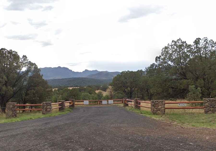
Is the dirt road to Lockes Gap open to vehicles?
The climb is short, spanning 6.27 km (3.9 miles) from the junction with the paved TX-118 highway. During the ascent, vehicles gain 230 vertical meters over an average gradient of 3.66%. The surface is entirely unpaved, with sharp loose gravel and packed dirt that requires a high-clearance 4x4. The lane is narrow and lacks any steel guardrails, leaving tires right on the edge of rocky shoulders where a single slip sends the vehicle into the desert brush. A heavy iron gate frequently blocks the path, as much of the surrounding mountain peak is managed for scientific research, restricting motorized access to authorized trucks and observatory traffic.
How do desert storms change the surface of Lockes Gap?
The ground quality on this mountain track depends entirely on the flash weather of the Trans-Pecos desert. While winters can pack the high altitude with freezing ice and sudden snowfall that leaves the gravel slick, the summer monsoons are the main threat.