Centralia Mountain: Driving the 9% Service Track in Jefferson County
At an elevation of 2,876m (9,435ft) above sea level, Centralia Mountain is a high summit in Jefferson County, Colorado. Located west of Denver within the Front Range, the peak is home to various communication towers, making the road to the top a vital but restricted service corridor.
| Road facts: Centralia Mountain | |
|---|---|
| Location | Jefferson County, Colorado, USA |
| Elevation | 2,876 m (9,435 ft) |
| Length | 3.05 km (1.9 miles) |
| Avg Gradient | 9.14% |
| Surface | Unpaved / Gravel and Rock |
How is the road to Centralia Mountain?
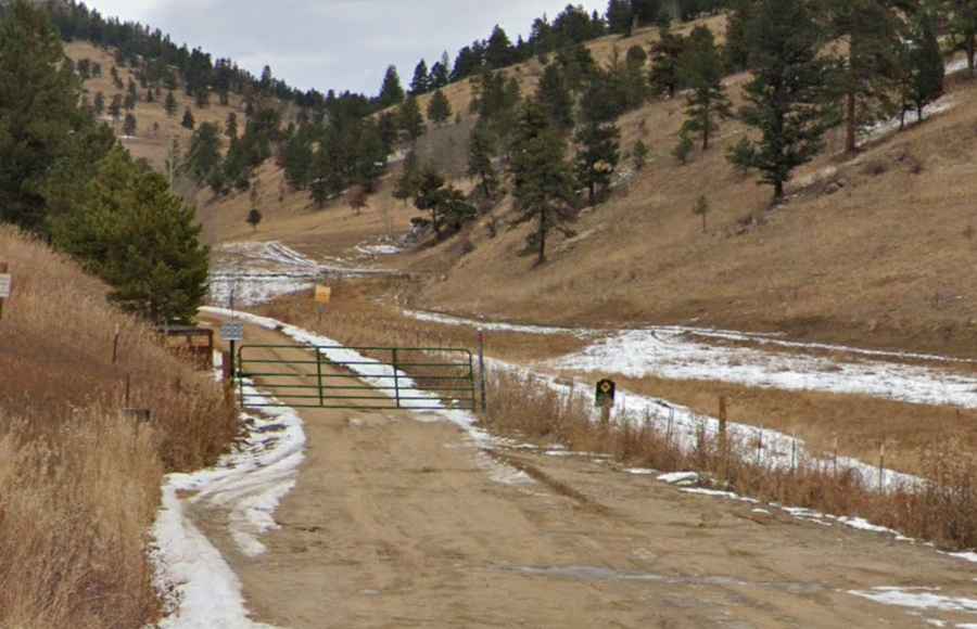
The climb begins at the junction with the paved County Road 70. The route to the summit is short but intense, covering only 3.05 km (1.9 miles) with a significant elevation gain of 279 meters. This results in a sustained average gradient of 9.14%. The road is entirely unpaved, consisting of a mix of loose gravel and hard-packed decomposed granite, typical of the Colorado Front Range. However, drivers should be aware that the road is blocked by a gate and access is strictly restricted to authorized personnel servicing the communication equipment at the summit.
Is the road to Centralia Mountain open in winter?
No. At nearly 9,500 feet, the road is seasonally impassable due to heavy snow accumulation. Because it is a service track and not a primary county road, it is not plowed for public use. Snow often remains on the shaded north-facing sections until late June or July. Even in the summer, the steep 9% grade becomes a mud hazard after the typical afternoon thunderstorms in Colorado, which can wash out sections of the gravel and create deep ruts.
What are the main hazards on Centralia Mountain?
The primary hazards are the steep incline and the lack of maneuvering space. The road is narrow, with no safety barriers and very few places to turn around if you encounter a service vehicle coming down. The loose granite surface can be slippery, especially on the steepest ramps, requiring 4x4 and high clearance to avoid bottoming out or losing traction. Because the peak is home to sensitive electronics, high-voltage equipment, and antennas, the area is frequently hit by lightning, making the summit extremely dangerous during storm activity.
Logistics and Restricted Access
Before planning any trip near Centralia Mountain, confirm the current access regulations. The presence of the gate at the start of the climb means that for most people, the summit is only reachable by foot or bike. There are no services, fuel, or water in the immediate area. Mobile signal is usually strong due to the towers on the peak, but if you are hiking or have permission to drive, ensure you are prepared for rapid temperature drops and high winds common at this elevation in Jefferson County.