How long is the road to Mount Tom in Jefferson County?
Mount Tom is a high mountain peak at an elevation of 2,889m (9,478ft) above sea level, located in Jefferson County, in the US state of Colorado. The summit is reached via a 5 km (3.1 miles) unpaved track that starts off Drew Hill Road, west of Golden.
| Road facts: Mount Tom | |
|---|---|
| Location | Jefferson County, Colorado (USA) |
| Elevation | 2,889 m (9,478 ft) |
| Length | 5 km (3.1 miles) |
| Surface | Unpaved / Rock and Dirt |
Is the road to Mount Tom open to the public?
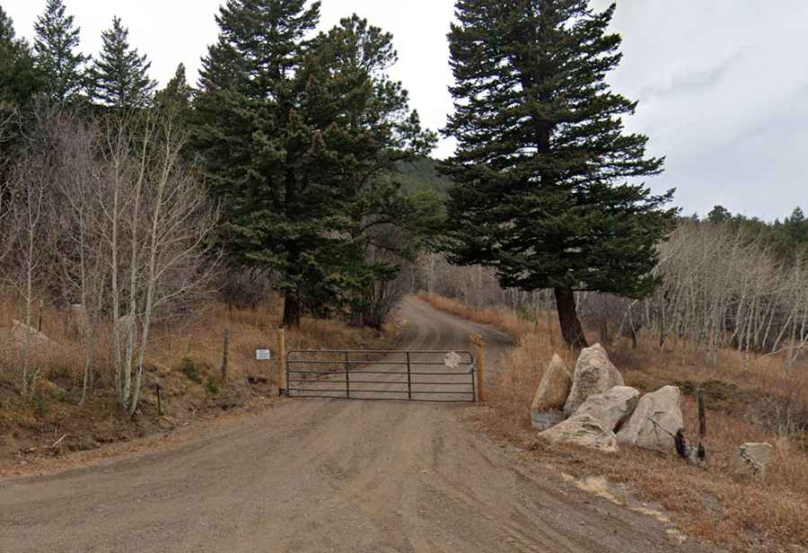
The access road to the summit is gated and motorized traffic is restricted to authorized service vehicles only. For the public, it is a dead-end route where cars must be left at the bottom.
Why is there a road to Mount Tom?
The 5 km track was built for fire access and to reach the communications equipment at the top, so it is not maintained for standard traffic. Even for authorized vehicles, the gate remains locked year-round to prevent illegal dumping and damage to the environment.
Is the road to Mount Tom unpaved?
The road is totally unpaved made of loose gravel and packed dirt. Because it receives zero maintenance, the surface is heavily eroded with deep ruts and washouts. There are no guardrails, and the track is very narrow, barely wide enough for one truck. High-clearance 4x4 vehicles only.
Is the road to Mount Tom open year-round?
At this elevation, the peak is buried under heavy snow from October until June. The road is never plowed, and massive snowdrifts completely block the track for months. Even in the height of summer, afternoon thunderstorms in the Rockies can turn the dry dirt into a slippery mess in minutes.
Why is Mount Tom famous?
The area is known for its history of aviation accidents, including a B-25 bomber crash in 1952.