Is the road to Mount Tom in Jefferson County unpaved?
Mount Tom is a high-altitude peak rising to 2,889m (9,478ft) above sea level in Jefferson County, Colorado. Located just west of Denver in the Front Range of the Rocky Mountains, the summit is reached via a rugged mountain track that branches off from the paved Drew Hill Road. It is a remote area where the weather and the terrain dictate the rules, far removed from the busy highways of the nearby Golden area.
| Road facts: Mount Tom | |
|---|---|
| Location | Jefferson County, Colorado (USA) |
| Elevation | 2,889m (9,478ft) |
| Length | 5 km (3.1 miles) |
| Surface | Unpaved / Gravel / Dirt |
| Access | Restricted (Gated) |
How long is the road to Mount Tom in Jefferson County?
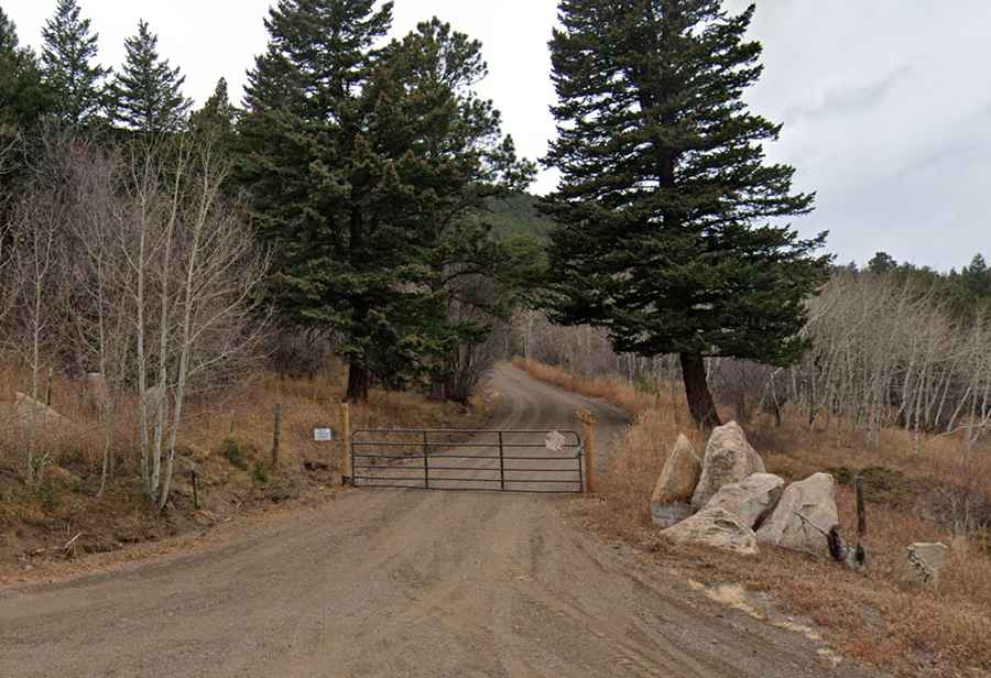
The climb to the peak covers 5 km (3.1 miles) of continuous unpaved track starting from Drew Hill Road. The road was built to provide access to the summit area, but today it serves mostly as a fire and service trail. The surface is a mix of loose gravel and packed dirt, with several steep sections that require steady momentum to avoid spinning the tires. However, the most important factor for drivers is that the road is blocked by a gate, restricting motorized access to authorized vehicles and making it a dead-end for public traffic.
What are the road conditions like on Mount Tom?
The track to Mount Tom is a raw Rocky Mountain road. Because it is gated and not maintained for heavy traffic, the surface is prone to erosion. Deep ruts can form after heavy rainstorms, and the lack of a proper drainage system means that mud becomes a serious issue in the lower sections. The incline is steady, and without the protection of guardrails, the narrowness of the path becomes apparent as you gain elevation. High-clearance vehicles are necessary to navigate the uneven ground and the rocky outcrops that often poke through the dirt surface.
Is the road to Mount Tom open in winter?
At nearly 2,900 meters, Mount Tom is under heavy snow for a large part of the year. The road is seasonally impassable and is never plowed. Snowdrifts often block the track until late June or even July, depending on the severity of the winter. During the spring thaw, the dirt turns into a thick slurry that makes the track extremely unstable. Even when the gate is open for authorized use, the window for driving to the summit is short, typically limited to the dry summer months and early autumn before the first major storms hit Jefferson County.
What makes the Mount Tom area dangerous for drivers?
The combination of altitude, isolation, and unpredictable weather makes this area a challenge. The mountain has a history of high-altitude accidents, including a fatal B-25 bomber crash in 1952 west of Golden. For drivers on the ground, the danger comes from sudden afternoon thunderstorms that can turn the dry dirt into a slippery mess in minutes. Visibility can drop rapidly as clouds move over the peak, and the lack of turnarounds on the narrow track means that if you encounter an obstacle or a wash-out, you may be forced to back down a significant distance on a surface with very little grip.