Is the road to Lundy Lake paved all the way?
Lundy Lake is a high-mountain lake at an elevation of 2,379m (7,805ft) above sea level, located in Mono County, in the US state of California.
Where is Lundy Lake?
The lake is located just north of Lee Vining and the eastern entrance to Tioga Road.
How long is Lundy Lake Road?
The road stretches for 10.78 km (6.7 miles) starting from its intersection with Highway 395. The route climbs west into the canyon, gaining elevation steadily until it dead-ends at the Lundy Canyon Trailhead at 2,502m. Being a dead-end road, all vehicles must return via the same path, descending toward the Mono Lake basin.
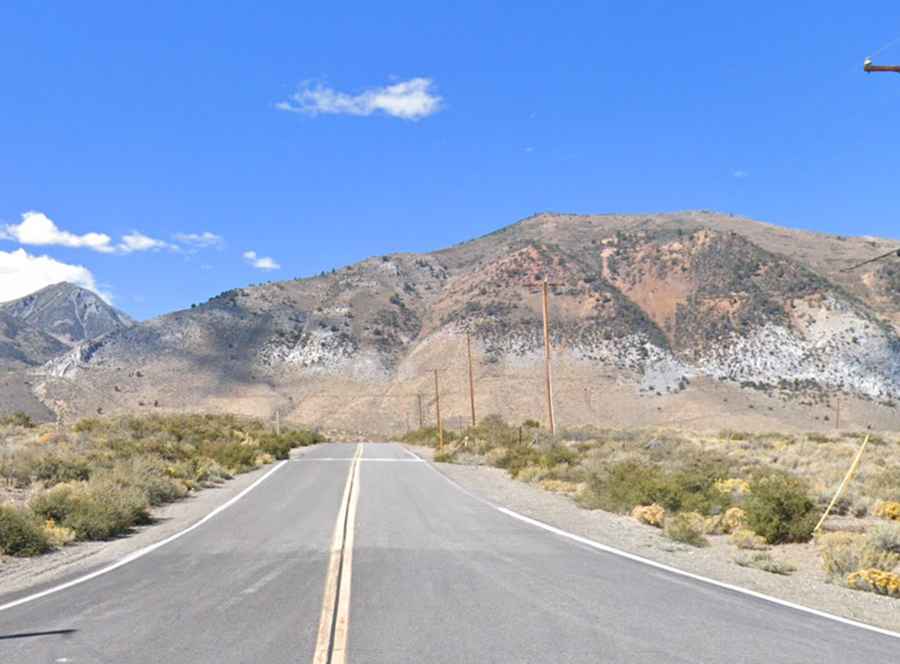
Is the road to Lundy Lake paved?
The road surface is split into two distinct sectors. The first section, from Highway 395 to the Lundy Lake Campground, is fully paved and accessible to all vehicle types. Beyond the campground, the pavement ends and the road becomes a rough gravel track for the final 3.2 km (2 miles). This unpaved section is narrow, features frequent washboard ripples, and leads directly to the upper trailhead. High-clearance vehicles are recommended for this final stretch to avoid underbody damage from loose rocks and deep ruts. Drivers must account for the lack of passing space on the narrowest sectors of the upper canyon road.
Is the road to Lundy Lake open in winter?
Set high in the Eastern Sierra Nevada, the main risk is the seasonal snowmelt, which frequently causes localized flooding and washouts on the gravel section during late spring. In winter, the road is not plowed past the residential areas near the lake, making the upper canyon inaccessible to wheeled traffic. The gravel track is often bordered by steep slate walls and loose scree slopes that can drop debris onto the roadbed after heavy rain.