The Ultimate Guide to Car Travel Around Phoenix: Scenic Drives and Hidden Gems
Driving in and around Phoenix, Arizona, is an exercise in managing thermal stress and navigating high-contrast terrains. While the city grid is highly optimized, the transition into the surrounding Sonoran Desert involves moving onto historic, unpaved routes where the environment is unforgiving. To explore the Phoenix basin safely, a driver must account for extreme ambient temperatures, rapid elevation changes, and the technical demands of desert mountain passes.
| Phoenix Region: Driving Intelligence | |
|---|---|
| Iconic Route | Apache Trail (SR 88) - Steep grades and gravel |
| Thermal Hazard | Summer temperatures often exceed 110°F (43°C) |
| Vehicle Requirement | High-clearance recommended for backcountry trails |
| Safety Priority | Cooling system integrity and hydration logistics |
1. The Apache Trail (SR 88): A Technical Challenge
Often cited as one of the most scenic yet demanding drives in Arizona, the Apache Trail winds through the Superstition Mountains.
- The Terrain: Portions of this route are unpaved and narrow, with sharp switchbacks and steep drop-offs. It is not a route for inexperienced drivers or low-clearance passenger cars.
- Operational Caution: Flash floods can transform dry washes into impassable torrents in minutes. Always check the weather forecast for the entire watershed, not just your immediate location.
2. Desert Thermal Management
The heat in the Phoenix area is a silent killer for vehicles. Before heading into isolated desert zones:
- Cooling System Audit: Ensure your coolant is at the correct concentration and your radiator fan is fully operational. Engine failure in 110°F heat is a life-threatening emergency.
- Tire Pressure: Heat causes air to expand. Check your tires early in the morning before they have been exposed to the road surface temperatures, which can reach 160°F.
- Hydration Logistics: Carry a minimum of one gallon of water per person per day. In the desert, if your car breaks down, you stay with the vehicle; having a water reserve is your primary survival tool.
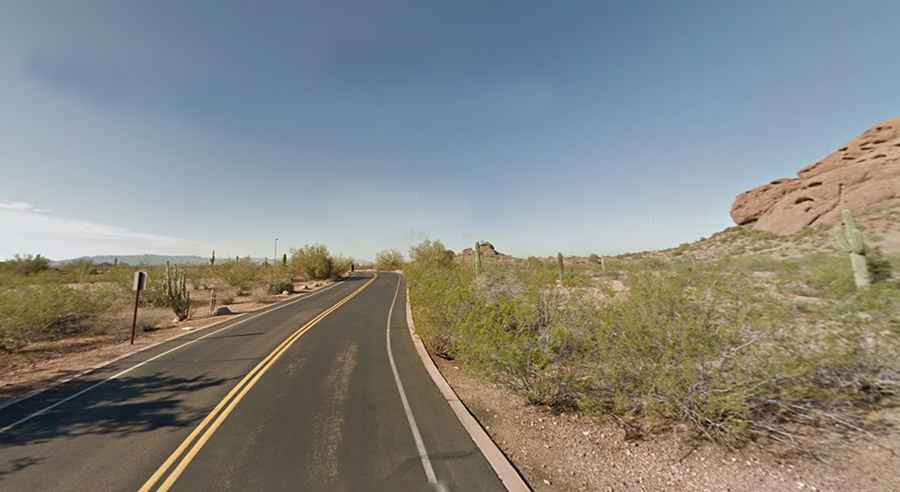
3. Strategic Viewpoints: South Mountain and Beyond
For a panoramic assessment of the valley's geography, South Mountain Park Drive offers significant elevation gain over a short distance. The road is paved but features tight curves that require constant attention to speed and lane position. It is an excellent location for sunset photography, but be prepared for high traffic volume and shared usage with cyclists.
4. Cultural Landmarks with High-Clearance Access
While spots like the Desert Botanical Garden are easily accessible via city arterials, other "hidden gems" like Mystery Castle or remote segments of the Roosevelt Row area require navigating older, narrower streets. If your itinerary includes off-road excursions into the Tonto National Forest, a 4WD vehicle with an emergency kit (including a shovel and traction boards) is highly recommended.
5. Urban Navigation vs. Desert Isolation
Phoenix's grid system is easy to follow, but the transition to rural routes happens quickly. Always maintain a physical map or offline GPS data. Cell service vanishes almost immediately once you enter the mountain canyons. Time your drives for early morning or late afternoon to avoid the peak thermal stress on both yourself and your vehicle's air conditioning system.
Conclusion: Respecting the Sonoran Environment
Exploring Phoenix by car is a rewarding experience that bridges the gap between urban sophistication and wild desert landscapes. However, the desert demands respect. By prioritizing vehicle maintenance, understanding the technical nature of routes like the Apache Trail, and staying disciplined with hydration, you can ensure that your Arizona journey is defined by its scenery rather than its hazards. Plan for the heat, drive for the terrain, and always keep a reserve of supplies.