Taking the scenic route and driving to Stevenson's Creek Falls in California
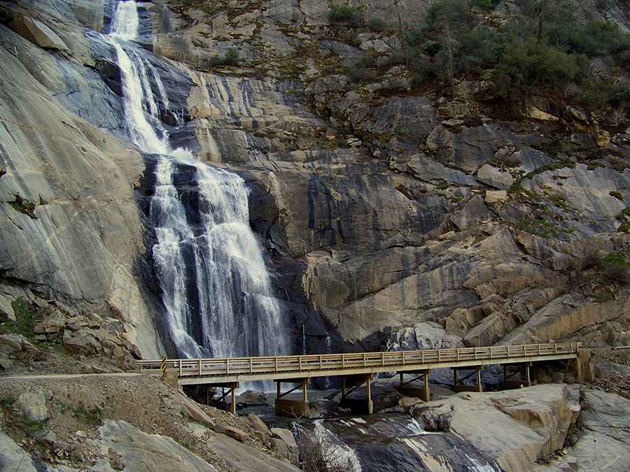
Stevenson's Creek Falls, nestled in Fresno County, in the US state of California, stands as one of the state's grandest waterfalls with an impressive drop of approximately 1,280 feet.
Why visit Stevenson's Creek Falls?
Positioned in central California, this cascade is the eleventh tallest in the state and reigns as the largest in Fresno County. The waterfall elegantly descends through the San Joaquin River Canyon in four tiers, eventually meeting the San Joaquin River.
Is the road to Stevenson's Creek Falls paved?
The route leading to the falls, known as both Million Dollar Road and Million Dollar Mile, is primarily paved. However, travelers should be cautious as portions of the road are quite narrow and can be challenging.
When was the road to Stevenson's Creek Falls built?
Deep within Sierra National Forest, this 11.42km (7.1 miles) stretch runs from Big Creek Powerhouse #3 to #8, cutting through the San Joaquin River Canyon. Constructed in 1922, this road gained its distinctive name, Million Dollar Road, due to the significant costs incurred per mile during its development. The road's construction was overseen by the Southern California Edison power company.
Can you drive directly to Stevenson's Creek Falls?
Visitors should be aware that the road has a gate at its beginning, restricting its usage. Only Southern California Edison vehicles, hikers, and cyclists are granted access.
Pic: David Hurst