How To Have The Ultimate Road Trip To Eureka Peak in Joshua Tree NP
Eureka Peak is a mountain peak at an elevation of 1.668m (5,472ft) above the sea level, located in San Bernardino County, in the US state of California.
Is the Eureka Peak Road in Joshua Tree National Park unpaved?
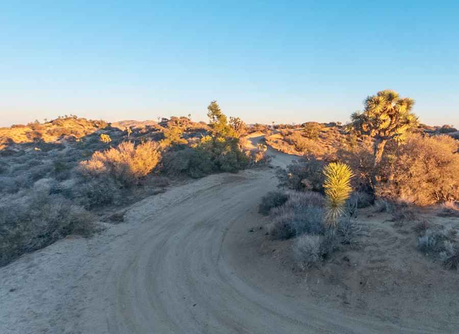
Located in the Black Rock Canyon region of Joshua Tree National Park, the road to the summit is totally unpaved and very sandy. It’s called Eureka Peak Road. The road up is well maintained and only has a couple of rough spots. In some parts, the sand can be quite deep. The road can be rutted, especially after a rain. High-clearance passenger vehicles should have no problem, but check with the rangers for the latest road conditions.
How long is Eureka Peak Road in Joshua Tree National Park?
Set high in Yucca Valley, the road is 2.09km (1.3 miles) long, starting from Covington Flat Road. Over this distance, the elevation gain is +113 m and the average gradient is 5.40%. There is a small parking area at the end of the road.
Is Eureka Peak Road in Joshua Tree National Park worth it?
Tucked away on the southern portion of California, the drive offers stunning views and takes you through one of the less visited parts of the park. At the summit you can enjoy the panoramic views of the San Bernardino Mountains and the Santa Rosa Mountains, replete with stunning desert landscapes that are dotted with iconic Joshua trees. Due to its remoteness from the rest of the park, the summit infrequently visited. Keep an eye out for snakes.
Pic: Peng Shi