Road trip guide: Conquering Morrell Mountain in Montana
Morrell Mountain is a high mountain peak at an elevation of 2.369m (7,772ft) above sea level, located in Powell County, in the U.S. state of Montana.
Where is Morrell Mountain?
The mountain is located to the east of Seeley Lake, in the northwestern part of Montana.
What’s at the summit of Morrell Mountain?
The summit hosts a fire lookout tower, built in 1962.
Can you drive to Morrell Mountain?
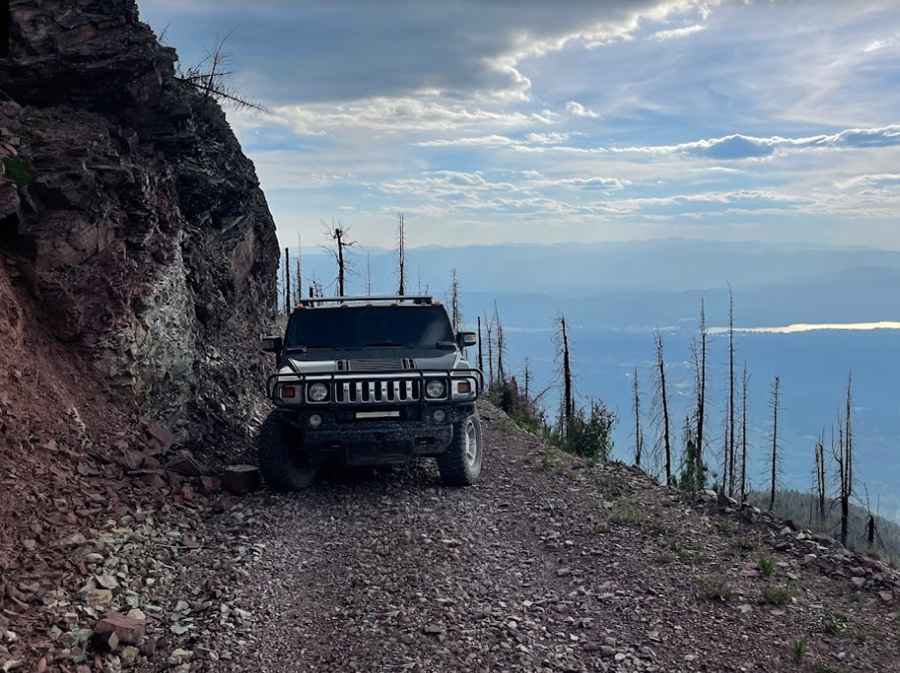
The narrow, single-lane mountain road to the summit is extremely steep and totally impassable for 2 cars at the same time, with steep drop-offs. It’s called Morrell Mountain Lookout Road (#4365). The last miles are rocky with a lot of switchbacks. The gravel road slightly deteriorates and becomes narrower as you get closer to the summit.
Is the road to Morrell Mountain open year-round?
Set high in Lolo National Forest, this road is usually impassable in winters (depending on snow).
How long is the road to Morrell Mountain?
Starting at Cottonwood Lakes Road, the road to the summit is 13.84km (8.6 miles) long. Over this distance, the elevation gain is 878 m. The average gradient is 6.34%.
Pic: Kevin Grimes