Driving the Roads of Pigeon Forge and the Great Smoky Mountains
Pigeon Forge serves as the primary gateway to the Great Smoky Mountains National Park, a region defined by dense forest canopies and high-elevation road networks. Driving these roads requires a focus on technical handling and situational awareness, as the terrain features steep gradients and sharp, unpredictable curves. Mastering the transit through this mountain corridor involves managing heavy tourist traffic while maintaining vehicle performance in one of the most visited natural areas in the United States.
| Smoky Mountains Driving: Route Metrics | |
|---|---|
| Key Technical Route | Roaring Fork Motor Nature Trail |
| Highest Point | Clingmans Dome (6,643 ft) |
| Road Surface | Paved but narrow; frequent steep inclines |
| Primary Hazards | Heavy congestion, wildlife, and rapid weather shifts |
What are the technical demands of the Roaring Fork Motor Nature Trail?
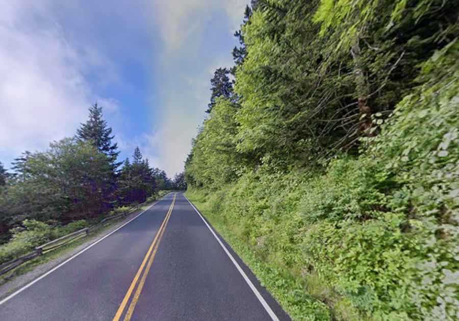
The Roaring Fork Motor Nature Trail is a prime example of a technical mountain road. Driving this road involves navigating narrow lanes, steep climbs, and sharp bends through a dense forest environment. Because the road is a one-way loop, motorists must maintain a steady pace to avoid bottlenecks. Professional drivers prioritize brake cooling and low-gear engine braking to manage the descent, especially when the asphalt is wet from the frequent mountain rains.
How to manage altitude and visibility when driving to Clingmans Dome?
Reaching Clingmans Dome, the highest point in the park, requires a significant ascent. Driving this road means operating at over 6,600 feet, where clouds and fog can reduce visibility to near zero within minutes. The road features wide vistas, but the focus must remain on the high-altitude curves and the potential for black ice during early spring or late fall. A well-maintained lighting system and reliable tires are mandatory for safely driving this peak-access road.
Why is logistics planning essential in high-traffic mountain hubs?
Pigeon Forge is a major logistical hub that experiences extreme seasonal congestion. Driving through Pigeon Forge requires patience and a strategic approach to time management. To reach the remote roads of the Smoky Mountains without getting stuck in urban gridlock, professional drivers often schedule their transits for early morning. This ensures a clearer run through the park's primary arteries and allows for better fuel efficiency by avoiding constant idling in heavy tourist traffic.
What are the risks of driving secondary roads and forest tracks?
Beyond the main paved loops, many secondary roads in the Smoky Mountains can be unforgiving. These routes often feature loose gravel, no guardrails, and limited cell service. If you are driving on these isolated roads, you must carry a basic survival kit and inform someone of your route. The beauty of the scenery can be a distraction; situational awareness is key to identifying potential washouts or fallen trees that frequently obstruct these mountain roads after storms.
Conclusion: The Professional Approach to the Smoky Mountains
Navigating the roads around Pigeon Forge and the Great Smoky Mountains is an exercise in technical precision and logistical planning. By prioritizing vehicle health and route timing, you ensure that the drive remains a controlled and successful expedition. Respect the gradients, monitor the weather, and master the road. In this mountain haven, your safety depends on your preparation and your focus behind the wheel.