How to manage the driving hazards and logistics of Interstate 5?
Interstate 5 (I-5), historically known as the West Side Freeway or the Pacific Highway, is the primary north-south logistical artery of the American West Coast. Spanning 1,381 miles (2,222 km), it serves as a critical link between the Mexican border in San Diego and the Canadian border in Blaine, Washington. Construction began in 1956 and was finalized in the 1970s, but the original engineering parameters are frequently exceeded by the current volume of over 200,000 vehicles per day. Logistically, the I-5 presents a fatality rate of 13.47 deaths per 100 miles, driven by a combination of extreme mountain gradients like the Tejon Pass and high-density commercial traffic.
| Road facts: Interstate 5 (I-5) Corridor | |
|---|---|
| Total Length | 1,381 miles (2,222 km) |
| Max Gradient | 6% (The Grapevine) |
| Highest Point | Siskiyou Summit (4,310 ft / 1,310 m) |
| Major Logistical Hubs | San Diego, Los Angeles, Sacramento, Portland, Seattle |
| Key Mountain Pass | Tejon Pass |
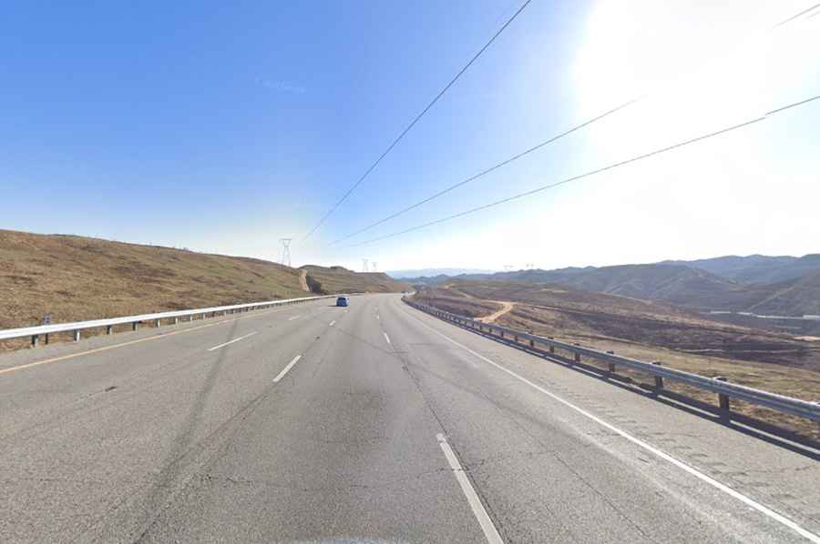
What makes the Tejon Pass and the Grapevine a mechanical hazard?
The Tejon Pass in Southern California is the most dangerous sector of the I-5 due to its rapid elevation changes. The northern descent, commonly called The Grapevine, features a 5-mile stretch with a 6% steep grade. This incline forces heavy commercial vehicles to descend at significantly lower speeds than passenger cars, often below 45 mph. For drivers, this requires constant monitoring of the speedometer and the implementation of engine braking. Relying solely on the brake pads for 5 miles on a 6% decline leads to thermal glazing and brake failure, a common cause of runaway truck accidents in this sector. The speed differential between slow-moving freight and high-speed passenger traffic is a primary factor in high-velocity rear-end collisions.
How to navigate commercial truck logistics and blind spots?
Interstate 5 is a heavy-duty freight corridor where semi-trucks and commercial vehicles are unavoidable. A fully loaded commercial truck can weigh up to 80,000 lbs, requiring 40% more distance to come to a full stop compared to a passenger vehicle. Logistically, trucks have massive blind spots (No-Zones) on all four sides. It is a technical safety requirement to avoid "lingering" beside a semi-truck, especially on the multi-lane sectors of Los Angeles and San Diego. Incorrectly loaded or unbalanced cargo in these trucks can also lead to stability issues during sudden lane changes or high-wind conditions in the Central Valley, increasing the risk of "jackknifing" across multiple lanes.
What are the weather hazards from California to Washington?
The 1,381-mile transit crosses diverse climate zones where weather-related hazards are constant. In the Tejon Pass, dust storms can create sudden "black-out" conditions with near-zero visibility, while high winds can push lighter vehicles out of their lane. Further north, the Tule fog in the San Joaquin Valley creates thick, low-lying visibility barriers that can persist for days. In Oregon and Washington, especially at the Siskiyou Summit (4,310ft), heavy rain and snow are frequent from October to April. These conditions make the asphalt slick and unpredictable, requiring a significant increase in following distances and the use of specialized tires or chains in high-elevation sectors.
Logistical bottlenecks at major West Coast intersections
The I-5 serves as the spine for several major metropolitan areas, where complex intersections increase the risk of side-swipe and yielding accidents. Drivers must manage lane-merging logistics at these critical points:
- San Diego: The connection with Federal 1 at the Mexican border and the I-15 interchange.
- Los Angeles: The high-density I-10 and US-101 interchanges where weaving traffic is constant.
- Sacramento: Intersections with US-50 and I-80 that handle massive regional commuter volumes.
- Portland: The I-84 and US-30 junctions crossing the Willamette River.
- Seattle/Everett: The I-90 and US-2 interchanges, where heavy rain often complicates lane visibility.
- Blaine: The final logistical transition to US-99 at the Canadian border.
These hubs require defensive driving and a high level of alertness to traffic patterns, as the outdated infrastructure in many 1950s-era sectors is not optimized for modern traffic volumes.
Vehicle maintenance and performance for the I-5 transit
A long-distance transit of Interstate 5 puts extreme mechanical stress on several vehicle systems. The high temperatures of the California valleys require a perfectly functioning cooling system to avoid overheating during slow-moving congestion. Conversely, the steep climbs of the mountain passes require optimal transmission performance. Before starting a multi-state route, it is mandatory to verify brake pad thickness, cooling fluid levels, and tire tread depth. In the northern states (Oregon and Washington), where precipitation is high, hydroplaning is a constant risk; ensuring your tires have adequate drainage channels is a technical priority. Logistically, while urban centers offer full mechanical support, the rural stretches of the West Side Freeway have limited services, making vehicle self-sufficiency a necessity.
How does traffic volume affect safety on the Pacific Highway?
With over 200,000 daily users, the "swarming" effect on the I-5 is a logistical challenge. High-density traffic leaves little room for error or sudden maneuvers. Reckless behaviors such as speeding (implicated in 28% of fatal accidents) and impaired driving (involved in 30% of fatalities) are exacerbated by the crowded nature of the freeway. Fatigue is another major logistical factor, especially for long-haul truck drivers attempting to meet strict deadlines. Drowsy driving leads to missed traffic cues and delayed reaction times. Maintaining a steady pace and following posted speed limits is the only technical way to navigate the I-5's outdated and often congested infrastructure safely from San Diego to Vancouver.