How To Have The Ultimate Road Trip To Modjeska Peak
Modjeska Peak is a high mountain peak at an elevation of 1,680m (5,511ft) above sea level, located in Orange County, in the U.S. state of California.
Where is Modjeska Peak?
Tucked away in the southern part of California, the peak is located within the Cleveland National Forest.
Why is it called Modjeska Peak?
The summit takes its name from Helena Modjeska, the renowned Shakespearean actress who spent her later years in Modjeska Canyon. She died in Newport Beach in 1909. If that interests you there are plenty of vacation rental beach houses there.
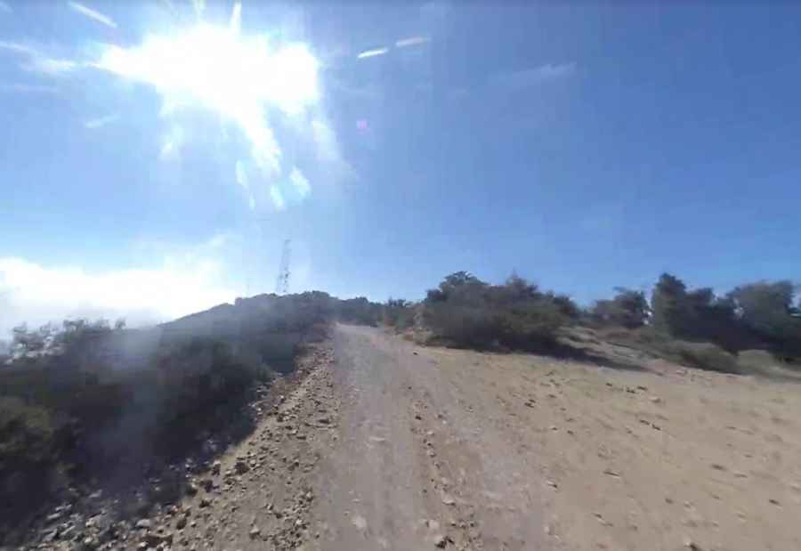
Can you drive to Modjeska Peak in California?
The road to the summit is a fire road totally unpaved. It’s called Harding Truck Trail. This is a fairly simple trail, though narrow with some loose, uneven surfaces. Most SUVs or trucks could drive the trail with no problem. Located to the north of Santiago Peak, the trail is often muddy with the melted snow and any additional rain during this season.
How long is the road to Modjeska Peak in California?
Starting from Modjeska Canyon, the road to the summit is 17km (10.6 miles) long. To drive the road without stopping will take most people between 1 and 2 hours.
Is the road to Modjeska Peak in California open?
Set high in the Santa Ana Mountains, the road is subject to closure depending on weather and fire danger level. Snow is fairly common above the 4,000' line in winter. Remember it can get very hot in the summer.
Is Modjeska Peak in California worth it?
The drive offers stunning views. The summit is the second highest point in Orange County and gives views of the northern Santa Ana summits such as Bald Peak and Bedford Peak. On a clear day, the visibility includes the ocean, Mt. Baldy, San Jacinto, San Gorgonio, and more. The view is definitely better than from Santiago Peak, because there are no antennas here.
Pic: Hristo Chilov