The 8 Most Challenging Roads of Olympic National Park
Located on Washington's Olympic Peninsula in the Pacific Northwest, Olympic National Park is a maritime-alpine wilderness that presents significant challenges for even experienced drivers. Tucked into the northwestern corner of Washington State, the park—often described as "three parks in one"—encompasses glacier-capped peaks, temperate rainforests, and a rugged Pacific coastline across 922,650 acres. While U.S. Highway 101 circumnavigates the peninsula, the interior routes are characterized by extreme narrowness, blind curves, and surfaces vulnerable to severe Pacific storms.
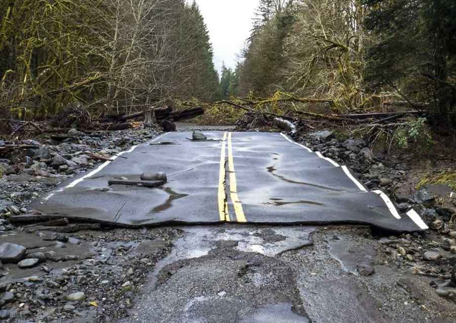
Navigating the park's secondary and gravel roads requires a high degree of situational awareness. Many routes feature steep gradients and sharp, unbanked turns where oncoming traffic, particularly in blind curves, creates a high risk of collision. In many sectors, road washouts due to the region's intense annual rainfall have permanently altered vehicle access, turning former driving routes into technical bike or foot paths. For those behind the wheel, the primary challenges are managing traction on saturated gravel and navigating corridors that are strictly prohibited for RVs and trailers due to severe geometry.
| Road Name | Distance | Surface | Technical Notes |
|---|---|---|---|
| Staircase Rd | 16 mi | Paved/Gravel | Winter closures; high humidity surface stress. |
| Deer Park Rd | 18 mi | Gravel | Strictly no RVs/Trailers; steep mountain ascent. |
| Hurricane Ridge Rd | 18 mi | Paved | High altitude; rapid weather shifts. |
| Obstruction Point Rd | 7 mi | Gravel | Highest road in the park; narrow with steep drop-offs. |
| Olympic Hot Springs Rd | 8 mi | Paved | Closed to vehicles; active road washout. |
| Sol Duc Rd | 13 mi | Paved | Winter closures; access to technical trailheads. |
| Graves Creek Rd | - | Gravel | RVs and trailers prohibited; extreme isolation. |
| Dosewallips Rd | 9 mi | Former Road | Closed to vehicles since 2002; non-driveable. |
Key Driving Considerations:
- Surface Saturation: Gravel roads in Olympic National Park can become destabilized during heavy rain events, leading to reduced traction and localized slides.
- Blind Curves: The dense vegetation and mountainous terrain mean many roads have zero visibility around corners. Use of low gears and headlights is recommended even during daylight hours.
- Vehicle Prohibitions: Due to narrow radii and lack of turn-around space, roads like Deer Park and Obstruction Point are strictly inaccessible for larger vehicles.
Conclusion: The Wild Peninsula
Driving the interior of Olympic National Park is a testament to the power of nature over infrastructure. From the high-elevation reach of Obstruction Point to the reclaimed paths of Dosewallips, these roads demand a professional respect for the environment. For the expeditionary driver, Olympic offers a rare look at how terrain and weather define the limits of the American road network.
Pic: https://www.nps.gov/media/photo/gallery-item.htm?pg=248462&id=2BD67C83-1DD8-B71B-0B541CCCDA3A4794&gid=C2864071-1DD8-B71B-0B6F39F05B126E36