The Ultimate Road Trip To Smith and Morehouse Reservoir in UT
Smith and Morehouse Reservoir is a high mountain reservoir at an elevation of 2.358m (7,736ft) above the sea level, located in Summit County, in the U.S. state of Utah.
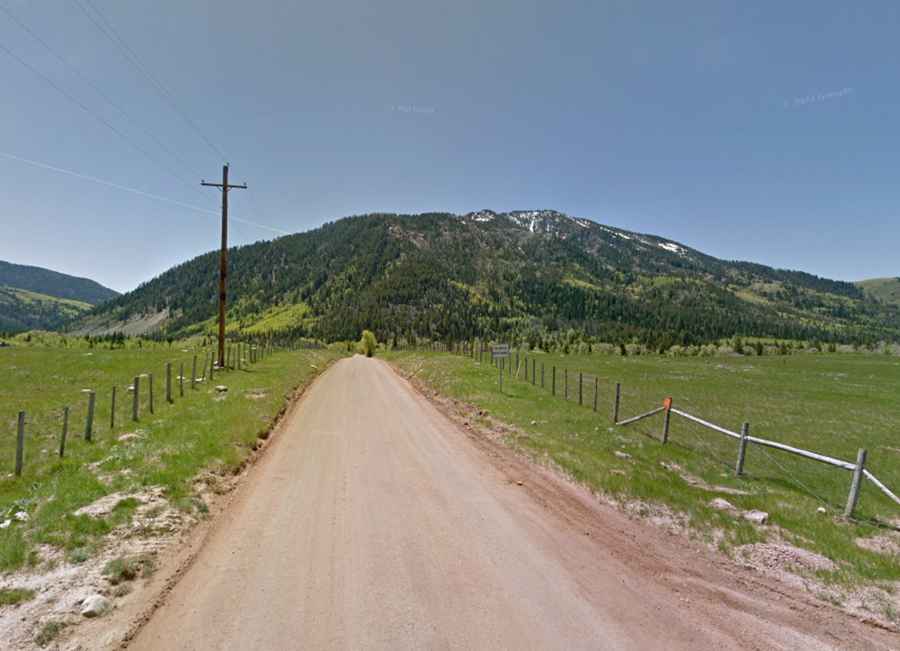
Is the road to Smith and Morehouse Reservoir in UT paved?
Set high in the Uinta-Wasatch-Cache National Forest, the rough dirt road to the reservoir is totally unpaved, with holes and ruts. It’s called Smith and Morehouse Road (Forest 033). A 4x4 vehicle is required. This road is highly trafficked.
How long is the road to Smith and Morehouse Reservoir in UT?
Tucked away in northeastern Utah, the track is not maintained and usually impassable in winters. Starting at the paved Weber Canyon Road, the road to the reservoir is 5.95km (3.7 miles) long. It’s mostly flat. To drive the road without stopping will take most people between 15 and 20 minutes.
Can you drive to Shingle Mill Flat in UT?
Located on the western edge of the Uinta Mountains, to the west of the reservoir, a minor gravel road (Forest Road 030) climbs up to Shingle Mill Flat, a pyramid-shaped peak at 3.002m (9,849ft) above the sea level. 4x4 vehicles only. The road is brutally steep.