The Most Iconic Coastal Roads in Louisiana
Louisiana’s road network is a marvel of hydraulic engineering, traversing some of the most complex wetland ecosystems in North America. Beyond the urban grid of New Orleans, the state’s infrastructure relies on extensive causeways and elevated byways designed to withstand tropical storm surges and the shifting silt of the Mississippi Delta. Navigating these roads offers a study in maritime-terrestrial transition, requiring drivers to manage high-velocity crosswinds and the unique mechanical stress of high-humidity environments.
| Louisiana Infrastructure: Technical Data | |
|---|---|
| Primary Engineering Feat | Lake Pontchartrain Causeway (23.8 miles) |
| Environmental Stressor | Sustained high humidity & hurricane storm surges |
| Topographical Feature | Bayou & Mangrove swamps (Zero-elevation terrain) |
| Key Transit Route | Great River Road (Mississippi River Corridor) |
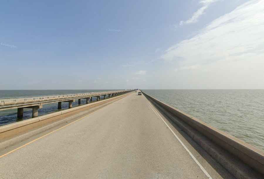
1. Lake Pontchartrain Causeway: The Longest Bridge Road
The Lake Pontchartrain Causeway remains the longest continuous bridge over water in the world. This twin-span structure is a critical logistical link for the New Orleans metropolitan area. Driving this 23.8-mile stretch is a unique experience where, at the midpoint, the land is completely invisible in all directions. The primary hazard here is the lack of shoulders and the vulnerability to intense fog and crosswinds that can rapidly compromise vehicle stability.
2. Bayou Teche Scenic Byway: Navigating the Swamps
The Bayou Teche corridor represents the quintessential swamp landscape of South Louisiana. Spanning 80 miles from Arnaudville to Franklin, the road winds through a labyrinth of wetlands and mangroves. For the driver, the challenge is the narrow geometry of the old bayou roads and the proximity to active wildlife habitats. This route requires constant monitoring of the asphalt, as the high water table can cause frequent surface irregularities and localized flooding during heavy precipitation events.
3. The Cajun Prairie: The High-Ground Transition
In contrast to the coastal marshes, the Cajun Prairie features rolling hills and open spaces that serve as a transition zone toward the Gulf of Mexico. These roads offer higher visibility but are subject to intense heat haze and agricultural traffic. The route leads through historic Acadian settlements, reflecting a period where the road network was secondary to the intricate system of navigable waterways.
4. The Great River Road: The Mississippi Artery
The Louisiana segment of the Great River Road follows the levee system of the Mississippi River. This is a high-tonnage corridor where industrial logistics meet rural history. The road provides a technical look at the levee engineering required to keep the river within its banks. Navigating these segments involves managing the "Great River" hydrology, where the road often sits below the river's water level, separated only by massive earthworks.
Conclusion: The Architecture of the Bayou
Louisiana’s iconic roads are a testament to human persistence against a volatile landscape. Whether crossing the expansive Lake Pontchartrain or the shaded tunnels of Bayou Teche, these routes demand respect for the environmental forces at play. For the expeditionary driver, Louisiana offers a rare opportunity to experience some of the most sophisticated wetland infrastructure on the continent, where the road is often the only stable platform in a world of water.