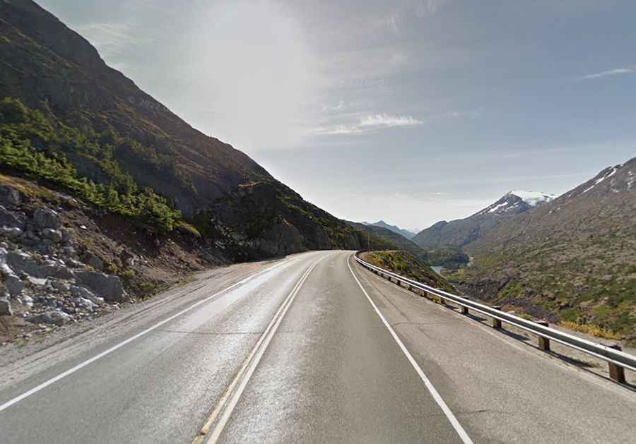
Driving the Klondike Highway to White Pass on the Alaska-Canada border
At 1,010m (3,313ft) above sea level, White Pass is much more than a gold rush memory. It’s a brutal climb that takes you from the sea level docks of Skagway, Alaska, straight up into the alpine tundra of British Columbia. This section of the Klondike Highway (Route 98) is a masterpiece of engineering, but don't let the smooth tarmac fool you. Between the 11% grades and the sudden Arctic weather, this road can turn from a scenic drive into a white-knuckle nightmare in minutes.
| Road facts: White Pass | |
|---|---|
| Location | Alaska (USA) - British Columbia (Canada) |
| Elevation | 1,010m (3,313ft) |
| Max Gradient | 11% |
| Length | 34.4 km (21.37 miles) |
Is the road to White Pass in Alaska difficult to drive?
The road is fully paved, but "easy" is not a word you’d use here. Starting from Skagway, you face a relentless 34 km climb with gradients hitting 11%. This isn't just a workout for your engine; it’s a test for your brakes on the way down. If you’re hauling a trailer or driving a heavy rig, you need to use your gears to slow down, or you’ll smell your brake pads burning before you’re halfway to the coast. The real killer here is the "whiteout"—heavy fog and blowing snow that can drop visibility to the hood of your truck in seconds, even in the middle of July.
Crossing the border: Customs and weather
The journey on the Klondike Highway takes you from the humid coastal air to the freezing winds of the summit in less than an hour. The US-Canada border sits right at the top, but the Canadian customs station is actually further inland at Fraser, BC. You must have your documents ready; being stuck at the border in a sub-zero wind is no fun. Also, watch out for the cruise ship tour buses. They dominate these roads during the summer, and they often take up more than their share of the narrow lanes in the tightest bends.
What to watch for: The Moore Bridge and Dead Horse Trail
As you drive, you’ll see the tracks of the White Pass & Yukon Route railroad hugging the cliffs across the gorge. One of the sketchiest-looking spots is the Captain William Moore Bridge, a suspension bridge that crosses an active earthquake fault line. Keep your eyes on the road, though; the drops are steep and there are very few guardrails that would actually stop a sliding car. Below the highway lies the old "Dead Horse Trail," a grim reminder of the thousands of pack animals that didn't survive the climb in 1898. If the mountain could kill horses back then, it can certainly wreck your car today if you don't respect the conditions.
Snow, ice, and wind: The year-round reality
Even when Skagway is sunny and 15°C, White Pass can be under a blizzard. The wind through this "corridor" is legendary, often reaching speeds that can rock a high-profile van. Snow clearing is constant, but during a heavy storm, the roads can be closed for hours or days. Always check the webcam at the summit before leaving Skagway. If you see clouds touching the ground, prepare for a slow, blind crawl to the top. This isn't a place for ego; if you can't see the tail lights in front of you, pull over and wait.
Driving the White Pass is a lesson in mountain physics. You’re fighting gravity on the way up and fighting your own momentum on the way down. Respect the grades, watch for the big buses, and keep your lights on for the fog. The roads of the North are unforgiving to those who rush. Check your tires, test your frens, and focus on the road. The gold is gone, but the danger remains. Stay sharp.