Arkansas Road Logistics: 5 Essential Scenic Byways and Route Planning Strategies
Executing a road mission through Arkansas requires a strategic understanding of the state’s complex topography, ranging from the Mississippi Delta to the Ozark Mountains. Arkansas is home to several federally designated National Scenic Byways that offer unique logistical challenges and high-value transit experiences. For professional operators and automotive enthusiasts, planning these routes involves analyzing terrain, vehicle insurance logistics, and regional infrastructure. This guide analyzes the top scenic corridors in Arkansas and the operational protocols required for a successful road trip.
| Arkansas Route Logistics Data | |
|---|---|
| Primary Corridor | Great River Road National Scenic Byway |
| Technical Route | Boston Mountains Scenic Loop (100-mile circuit) |
| Risk Management | Comprehensive rental insurance and terrain assessment |
| Operational Hubs | Hot Springs, Eureka Springs, and Fayetteville |
How to Navigate the Great River Road National Scenic Byway?
The Great River Road is one of the most significant logistical corridors in Arkansas, following the Mississippi River’s course. Navigating this byway requires understanding the cultural and geographical diversity across the ten states it traverses. When operating a rental vehicle on these roads, it is a mandatory logistical protocol to secure comprehensive insurance to mitigate financial risk from unexpected road hazards or mechanical issues. This route offers a technical study in river-valley transit and long-distance driving endurance.
What Makes the Boston Mountains Scenic Loop a Technical Drive?
The Boston Mountains Scenic Loop is a 100-mile high-elevation circuit that provides a technical driving experience through the Ozarks. This route includes several steep gradients, sharp overlooks, and forest-density challenges. Logistically, its proximity to Fayetteville makes it an ideal short-haul mission for testing vehicle handling and braking systems on winding mountain roads. The loop integrates several national forest access points, requiring drivers to stay alert to sudden changes in road surface and wildlife crossings.
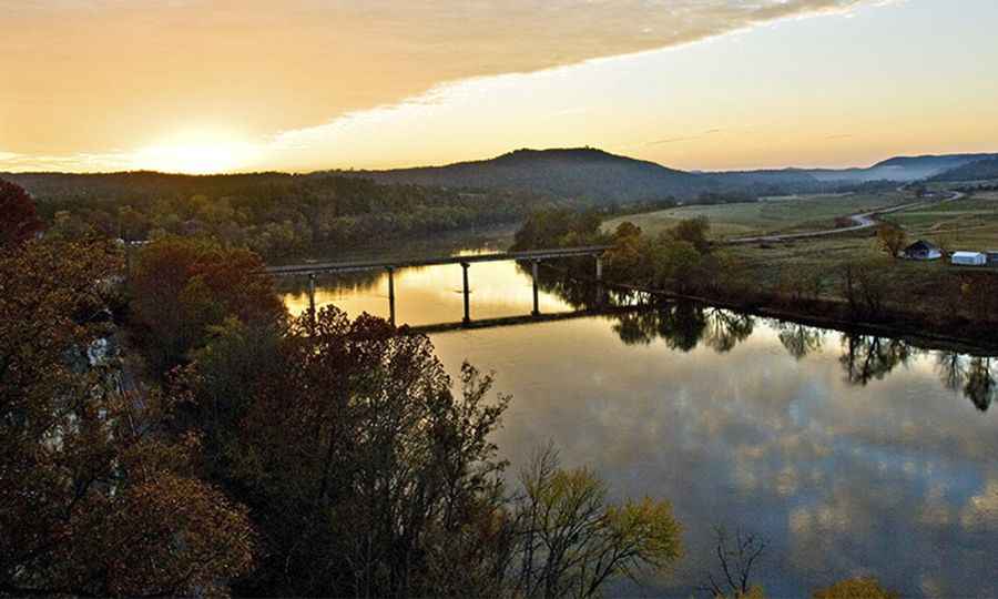
Analyzing the Sylamore Scenic Byway and Highway 65 Logistics
The Sylamore Scenic Byway meanders through the Ozark National Forest and the Buffalo National River, offering a complex logistical path through mountains and valleys. In parallel, Highway 65 serves as the primary north-south logistical artery in Arkansas, connecting Brinkley to Texarkana. These roads are essential for both commercial freight and passenger transit. Effective route planning on Highway 65 involves managing transit times between key hubs and ensuring vehicle readiness for varying weather conditions throughout the state.
Route Strategy: From Hot Springs to Eureka Springs
A strategic road mission across Arkansas often begins in Hot Springs, a historic hub within the National Park system. The transit toward Eureka Springs—a Victorian-style town in the Ozarks—involves navigating secondary highway systems that demand high levels of situational awareness. These routes are characterized by significant elevation changes and aesthetic infrastructure, such as the Thorncrown Chapel. For any traveler, maintaining a balance between speed and terrain appreciation is the hallmark of professional road conduct.
Conclusion: Operational Excellence on Arkansas Roads
Arkansas offers a diverse array of logistical challenges for any road traveler. By prioritizing route planning, vehicle insurance, and an understanding of the state’s scenic byway system, you ensure a safe and efficient mission. Whether you are navigating the Mississippi floodplains or the Ozark peaks, the quality of your preparation defines the outcome of your journey. Study your maps, check your coverage, and focus on the road. Arkansas is a premier destination for those who value the art of the drive.
Pic: https://www.arkansas.com/calico-rock/motoring/sylamore-scenic-byway