Beyond the Clouds: A Guide to Colorado’s Highest Roads
Colorado is the ultimate high-altitude proving ground in the United States. Dominated by the Rocky Mountains, the state offers a landscape where pristine alpine tundra meets the rugged remains of the 19th-century Gold Rush. For the adventure motorist, Colorado is less about the destination and more about the ascent. This 5-day expedition focuses on the technical climbs and historic trails that define the "Centennial State."
| Colorado High-Altitude Logistics | |
|---|---|
| Max Elevation (Trail Ridge) | 12,183 ft (3,713 m) |
| Key Road Hazard | Rapid weather shifts & High-altitude hypoxia |
| Winter Closures | October to late May (Heavy Snowfall) |
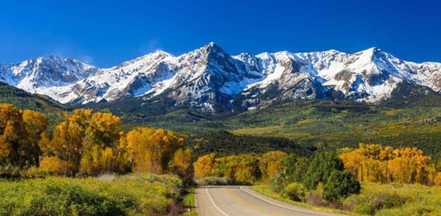
1. The Alpine Backbone: Rocky Mountain National Park
The core of this route is the Trail Ridge Road (Highway 34). Known as the "Highway to the Sky," it is the highest continuous paved road in the United States. Reaching a peak of 12,183 feet, it takes drivers from lush forests to the desolate, windswept alpine tundra in minutes.
Driver Alert: Engine performance drops significantly at this altitude due to thinner air. Ensure your cooling system is in top condition, and use low gears on the descent to manage speed without overheating your brakes on the long 8% gradients.
2. Peak to Peak Highway: The Scenic Buffer
Stretching from Estes Park to Central City, the Peak to Peak Highway is Colorado's oldest scenic byway (established in 1918). It serves as a tactical connector through the Roosevelt National Forest. Along this route, the main hazards are wildlife crossings—specifically Elk and Bighorn Sheep—which are most active at dawn and dusk. Maintaining moderate speeds through the winding Boulder Canyon is essential for safety.
3. The Gold Trail: Navigating Mining History
The fourth stage of the journey dives into the heart of the Colorado Gold Trail. Towns like Georgetown, Idaho Springs, and Central City are living museums of silver and gold mining.
- Georgetown: A former silver camp sitting at 8,500 feet. The steep, narrow streets are a precursor to the shelf roads found deeper in the mountains.
- Idaho Springs: Home to the Argo Gold Mine. This area requires vigilance due to the steep, rocky slopes that can occasionally shed debris onto the roadway after heavy rains.
4. Red Rocks and the Mile-High Descent
As the route descends toward Denver, the final technical stop is Red Rocks Park. Famous for its massive red sandstone monoliths, the park features narrow, winding roads that lead to its iconic natural amphitheater. The transition from the high peaks to the "Mile-High" elevation of Denver (5,280 ft) still requires focus on hydration and vehicle temperature management, as the air remains significantly thinner than at sea level.
Expedition Preparation Checklist
- Altitude Sickness: Above 8,000 feet, hypoxia can cause dizziness. If symptoms persist, descend immediately.
- Offline Maps: GPS signals are notoriously unreliable in deep canyons like Boulder Canyon. Always carry physical topographic maps.
- Emergency Gear: Even in summer, mountain temperatures can drop below freezing. Carry blankets, jump leads, a full-size spare tire, and extra water.
Planning your Colorado expedition with these factors in mind ensures that you respect the power of the Rockies while enjoying one of the world's most spectacular driving environments.