How to drive the unpaved road to the lookout at Garnet Mountain in Montana
Garnet Mountain is a high mountain peak at an elevation of 2.516m (8,254ft) above sea level, located in Gallatin County, in the U.S. state of Montana.
Where is Garnet Mountain?
The peak is located south of Bozeman, in the southern part of Montana, within the Custer Gallatin National Forest.
Why is there a road to Garnet Mountain?
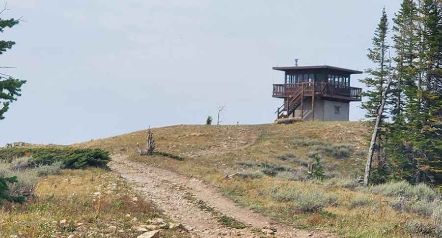
The summit hosts a fire lookout tower since 1930. The current structure was built in 1962. The views at the top are unreal. The lookout provides a panoramic view of the surrounding peaks and valleys.
Is the road to Garnet Mountain unpaved?
The road to the summit is totally unpaved. It’s called Forest Service Road 3112. 4x4 vehicles only. It is not accessible by vehicles wider that 50 inches.
How long is the road to Garnet Mountain?
Starting at Storm Castle Road, the road is 8.20km (5.1 miles) long.
Is the road to Garnet Mountain open year-round?
The road is totally impassable in winters. Sometimes the mud makes the road semi impassable.
Pic: Tony Tornado